Time-crunched adventurers find a rare trifecta: history, adrenaline, and raw nature near LA. This 9.5-mile trail winds through alpine forest, requires six river crossings, and ends at a 1936 bridge abandoned post-1938 floods. The 120-foot bungee jump adds thrill, but the 4-hour trek itself—where water meets stone—epitomizes human ambition versus nature’s might.
Ever felt LA’s trails lack soul? The Bridge to Nowhere hike in the San Gabriel Mountains defies that—this 1936 relic, built for a road swept away by floods, now looms above a turquoise canyon. The East Fork Trail adventure (9.5 miles round trip, moderate difficulty) challenges hikers with six icy river crossings, hidden swimming holes, and the eerie thrill of walking where a forgotten dream vanished.
I’ll unpack gear that survives slippery rocks, why sunrise starts beat weekend crowds, and eco-smart practices to protect this fragile canyon—plus the cliffside rush of Bungee America’s leaps. It’s not just a hike—it’s a 10-mile journey through history, risk, and raw beauty.
- The hike at a glance: your complete trail overview
- The story of an abandoned dream: history of the bridge
- What to expect on the trail: a journey through the canyon
- The ultimate thrill: bungee jumping from the bridge
- Your essential safety and preparation guide
- Insider tips for the perfect adventure
- Planning your visit: access, permits, and timing
The hike at a glance: your complete trail overview
A relic of history in the heart of the mountains
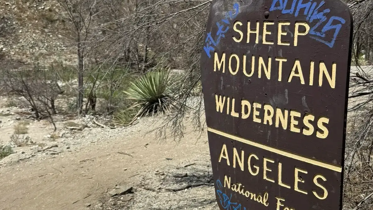
Hike through California’s Sheep Mountain Wilderness to discover a 1930s bridge frozen in time. Built in 1936 as part of a road linking San Gabriel Valley to Wrightwood, it was abandoned after 1938 floods destroyed its routes. Now, this 120-foot structure stands isolated—a symbol of resilience and Los Angeles’ most iconic adventure hike.
This trail blends history, wilderness, and challenge. River crossings, bighorn sheep sightings, and the surreal sight of a mid-century bridge in a wild canyon make it unforgettable. It’s not a stroll—it’s a journey that demands engagement with nature’s shifting moods.
Key trail stats and information
| Feature | Details |
|---|---|
| Trail Name | Bridge to Nowhere Hike via East Fork Trail |
| Location | San Gabriel Mountains, Angeles National Forest, CA |
| Total Distance | ~9.5 miles (15.3 km) round trip |
| Elevation Gain | ~1,246 feet (380 meters) |
| Estimated Time | 4 to 6 hours (depending on pace and water levels) |
| Difficulty | Moderate (rocky terrain and multiple river crossings) |
| Trail Type | Out-and-back |
| Dogs Allowed? | Yes, on leash (be mindful of rocky sections) |
This isn’t just a hike—it’s a narrative of human ambition and natural forces. The numbers frame the challenge, but the true magic lies in wading through icy waters and tracing remnants of a vanished road.
River crossings define the East Fork Trail. Water levels shift rapidly—ankle-deep streams can become waist-high torrents. Pack quick-dry sandals and extra socks. Trust me: wet shoes won’t dull the thrill of rugged canyons and the bridge’s stark silhouette against the mountains.
The story of an abandoned dream: history of the bridge
The grand road that never was
Picture a bridge built with grand ambitions, only to lead nowhere. The East Fork Road was designed in the 1930s to connect San Gabriel Valley to Wrightwood. Construction began in 1936, creating a 120-foot arch spanning the East Fork River—a feat of engineering. But nature intervened.
In 1938, two storms unleashed a year’s rain in days. Floods claimed 115 lives, erased communities, and obliterated the East Fork Road. The bridge, miraculously spared, became a haunting relic.
A testament to human ambition and nature’s raw power, the bridge stands as a monument to a road swallowed by the river.
The bridge today: a destination for adventurers
Now a hotspot for hikers and thrill-seekers, the Bridge to Nowhere defies its isolation. The 10-mile hike through rugged canyons ends at the surreal sight of the bridge suspended above the river—a stark contrast to the wild landscape.
Bungee America offers jumps from the bridge, Southern California’s only legal bungee spot. A twist 1930s engineers couldn’t foresee: a forgotten structure reborn as a playground. This bridge, once a dead end, now leads to stories worth telling.
What to expect on the trail: a journey through the canyon
Your first steps on the East Fork Trail
Start at the East Fork Trailhead, where the adventure begins with a wide dirt road winding through the San Gabriel Mountains. The path narrows past Heaton Flat, tracing the edge of the San Gabriel River. This is where the trail’s true character emerges.
Navigate split paths and cairns marking the way. The route feels alive with history—remnants of the 1930s road project crumble underfoot. Download an offline map. Sections feel like a choose-your-own-adventure, but the reward? A story etched in river stones and canyon echoes.
Navigating the famous river crossings
The East Fork isn’t a trail—it’s a dance with the river. Six crossings await, each demanding focus. The water’s depth shifts like a mood: ankle-deep in summer, waist-high after spring rains. Algae-slicked rocks laugh at complacency; move slowly, stick in hand.
- The number of crossings: at least six major crossings each way, so be prepared for a wet journey.
- The water depth: it can vary from ankle-deep to waist-deep, depending on the season and recent rainfall.
- The riverbed: expect a mix of sand, gravel, and slippery, algae-covered rocks. Move slowly and deliberately.
- The footwear strategy: embrace the water! It’s much easier to wear quick-drying trail shoes or sturdy water sandals for the entire hike.
Resist the urge to swap shoes. Wet socks dry mid-hike. Trekking poles? Non-negotiable. They’re lifelines for balance, turning treacherous rocks into manageable steps. This isn’t a hike—it’s a lesson in adaptability.
Reaching the final destination
Then—there it is. The Bridge to Nowhere looms, a concrete ghost from 1936, defying the canyon’s wildness. The structure hums with history. Below, natural pools glint like hidden treasures. Dip into their cool embrace, earned by soaked shoes and steady nerves.
Weekend crowds amplify the scene: laughter from bungee jumpers punctuates the air. Dare to leap 120 feet into the void? Or savor the quiet of a weekday visit, where the only soundtrack is water and wind. Either way, this bridge isn’t a dead end—it’s a portal to LA’s most surreal adventure.
Turn back knowing this: the San Gabriels don’t just test your legs. They remind you that the best trails leave stories in your bones.
The ultimate thrill: bungee jumping from the bridge
Taking the leap with Bungee America
For adrenaline seekers, the Bridge to Nowhere isn’t just a hike—it’s a chance to jump 120 feet into a canyon. Bungee America, the only legally sanctioned operator in Southern California, turns this abandoned structure into a playground. The jump combines history with heart-pounding energy, set against the raw beauty of the San Gabriel Mountains. Safety is paramount: every harness and cord meets California’s strict engineering standards, inspected annually by state officials. It’s a certified rush, designed for thrill-seekers who crave stories as much as sensations.
What to know before you book
Reservations fill fast—book weeks ahead if weekends suit your schedule. Jumps start at dawn (6-7 a.m.), a detail that shapes your entire day. Early arrival isn’t just for jumpers; it’s the secret to avoiding crowds on the trail. Even without leaping, watching others plunge adds drama to the hike. As the blockquote captures:
Watching people leap into the canyon adds a surreal, adrenaline-fueled energy to this already unique place. It’s a powerful reminder of how we seek adventure in the wildest spaces.
Bring a GoPro, but prioritize presence. This is where history and human daring collide, 120 feet above the East Fork.
Your essential safety and preparation guide
Understanding the risks: water, weather, and wildlife
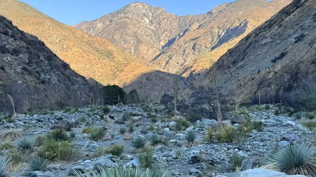
Water crossings dominate the Bridge to Nowhere hike, but they’re not just a splashy adventure. Flash floods can turn calm rivers into deadly torrents, especially after rain. The 2023 Bridge Fire stripped hillsides of vegetation, increasing debris flow risks. Never attempt the hike during or after storms.
Summer heat in the canyon is relentless. Temperatures often exceed 85°F (30°C), with little shade. Start before sunrise to beat the heat and avoid heat exhaustion. Carry at least 2–3 liters of water per person.
Watch for juvenile rattlesnakes sunning on rocks. Keep dogs leashed and stick to the trail. Respect wildlife from a distance—binoculars work better than curiosity for spotting bighorn sheep or hawks.
Staying found and connected
Cell service vanishes once you leave East Fork Trailhead. Download offline maps via AllTrails before departing. Mark key waypoints like Heaton Flats to avoid confusion at trail junctions.
For emergencies, carry a satellite messenger. The Garmin inReach Mini 2 is reliable for SOS alerts and text messages. Even seasoned hikers get disoriented here—don’t rely on intuition alone.
Check weather forecasts in Azusa before starting. Sudden thunderstorms upstream can swell the river. If skies darken, turn back immediately. The bridge isn’t worth risking a flash flood.
Hiking with respect: leave no trace principles
This trail’s beauty depends on collective care. Pack out all trash—yes, even apple cores. The 2023 fire left fragile terrain; crushing vegetation now delays recovery for decades.
Stay on marked paths to prevent erosion. If you spot a social trail (unofficial path), avoid it. When swimming in the river’s pools, use biodegradable sunscreen to protect aquatic life.
Teach kids (or your group) to leave rocks, plants, and artifacts undisturbed. A “trash-to-treasure” game—collecting litter—makes stewardship fun. As a mom, I’ve learned small actions shape lasting travel ethics.
Remember: every hiker here shares this space. Respect quiet hours at campsites and yield to equestrian users. The goal? Leave the San Gabriels as wild tomorrow as they are today.
Insider tips for the perfect adventure
My essential packing list
- Sturdy water shoes or trail runners. Flip-flops risk being swept away in fast currents. Opt for models with aggressive treads.
- 2-3 liters of water per person—hydration is non-negotiable under the relentless sun. Consider a hydration bladder for easy access during crossings.
- Salty snacks like pretzels and electrolyte tablets to replace minerals lost through sweat. Pair with energy bars for sustained fuel.
- Sun protection: A wide-brimmed hat, UV-protected sunglasses, and reef-safe sunscreen. Reapply frequently—the canyon amplifies UV exposure.
- Trekking poles for stability during unpredictable river crossings. Aluminum models handle rocky terrain better than carbon fiber.
- A waterproof dry sack for electronics and spare socks—river immersion is inevitable. 20L size fits essentials without bulk.
- A quick-dry towel if you plan to swim near the bridge’s natural pools. Compact options dry in minutes.
More tips from a fellow traveler
Weekday hikes transform this popular trail into a serene sanctuary—fewer crowds mean uninterrupted canyon views. Arriving before 7AM on weekends guarantees parking at East Fork Trailhead, where spaces vanish by 8AM. Avoid the trail after heavy rainfall—flash floods have turned fatal.
Dogs love the adventure but struggle with rocky terrain. Protect their paws with booties and carry them through deeper crossings. For navigation, download the AllTrails map—multiple river intersections confuse even seasoned hikers.
If combining with bungee jumping, book early. Watching jumpers adds spectacle, but the activity’s 120ft plunge demands advance reservations. Post-hike, rinse off at Heaton Flat’s shallow pools. Local secret: Visit in early September when summer crowds dissipate but water temperatures remain ideal for dips.
Every item in your pack—from electrolytes to blister kits—should prioritize function over convenience. Trust me: soaked shoes and sunburns will haunt your memories longer than the bridge’s surreal isolation ever will. For eco-friendly travel, avoid trampling fragile riparian zones. This trail’s magic lies in its wildness—preserve it for future explorers.
Planning your visit: access, permits, and timing
Getting to the East Fork Trailhead
East Fork Trailhead sits at Camp Bonita Rd, La Verne, CA 91750. It’s just 60 minutes from downtown Los Angeles, but weekends mean traffic. The road winds through Angeles National Forest—watch for sharp turns. Pro tip: Use GPS, not just phone maps. Cell reception fades fast once you’re inside the canyon.
Parking and required passes
Arrive before sunrise or face chaos. The lot fills by 7 AM on weekends. A Adventure Pass ($5/day or $30/year) or America the Beautiful pass is mandatory. Buy passes online at myscenicdrives.com or local vendors beforehand—ranger stations sell out fast. No pass? An “NRF” (Notice of Required Fee) ticket waits. Weekday hikers skip the stress: fewer cars, more solitude.
The best time of year to go
Autumn reigns supreme. Water levels drop, temperatures cool, and summer crowds vanish. Spring brings wildflowers but icy, waist-deep river crossings. Summer demands 5 AM starts—afternoon heat hits 90°F+ in the exposed canyon. Winter? Risky. Flash floods and icy currents dominate. Social Proof from AllTrails: 90% of 9,606 reviews call autumn the sweet spot. Check weather reports: rain ≠ trail closure, but swollen rivers kill plans fast.
Insider access tips
Weekdays = hidden gem. One hiker found zero people at the bridge by starting at sunrise on a Tuesday. For bungee-jumpers, Bungee America’s 6 AM slots mean empty trails—but skip if peace matters. Never attempt post-rain: in 2023, two rescues happened after sudden storms. Pack a waterproof map: GPS glitches near the river. Lastly, dogs? Sure, but river rocks wreck paws—carry them if they’re small.
The Bridge to Nowhere Hike combines history, adventure, and natural beauty in a unique Southern California experience. With its intriguing abandoned bridge, river crossings, and canyon views, it’s a story-rich trail. Approach with essentials, water-ready gear, and leave-no-trace respect to preserve its wild charm. Whether hiking or leaping, this trail shows the best destinations surprise with resilience and mystery.
FAQ
What makes the Bridge to Nowhere hike challenging, and who is it suited for?
The Bridge to Nowhere hike is a moderate 9.5-mile round-trip adventure with rocky terrain, elevation gain (1,246 feet), and six river crossings. While not technically demanding, the trail requires balance and caution, especially during high water levels. As a parent who values family adventures, I’d say it’s ideal for active travelers comfortable navigating nature’s obstacles. The key challenge lies in the river crossings—wear water-friendly shoes and embrace the wet journey. If you’re seeking a mix of history and physical engagement, this hike delivers.
Is the Bridge to Nowhere currently accessible, or has it reopened after recent events?
Yes, the trail is open! After the 2023 Bridge Fire, which scorched 56,030 acres and left the canyon partially charred, the path has been restored. However, winter rains can complicate conditions due to unstable terrain from the burned landscape. I’ve hiked similar trails with my kids—always check weather forecasts and avoid the hike during storms. The wilderness here feels raw and untouched, a reminder of nature’s resilience.
Do you need a permit or parking pass for the Bridge to Nowhere hike?
Absolutely—bring your Adventure Pass or America the Beautiful Pass. The East Fork Trailhead parking fills rapidly, especially on weekends. Arrive at sunrise to secure a spot (trust me, the early start pays off). While the Sheep Mountain Wilderness self-issued permit exists, it’s rarely enforced. Still, I carry mine—it’s a small act of respecting the land we explore.
How long does the Bridge to Nowhere hike take, and what’s the ideal pace?
Plan for 4 to 6 hours, depending on river conditions and how long you linger at the bridge. I prefer a relaxed pace, soaking in the canyon’s energy and letting children explore safely. The route’s rhythm—alternating between forested paths and river wades—creates a meditative flow. Don’t rush; the journey’s magic lies in its unhurried moments.
How tall is the Bridge to Nowhere, and why does it matter?
At 120–130 feet high, the bridge arches dramatically over the San Gabriel River. Its height isn’t just a thrill for bungee jumpers—it’s a testament to human ambition. Standing beneath it, I reflect on the 1936 builders’ vision, halted by nature’s 1938 flood. The scale reminds us to tread lightly in wild spaces, a lesson I share with my kids.
What’s the average time to hike 10 miles, and how does this apply here?
While generic advice says 4–6 hours for 10 miles, the Bridge to Nowhere’s river crossings slow you down. Each wade demands focus, and the 9.5-mile loop feels longer. I’ve learned to pack a picnic and sunscreen—this isn’t a race. The water’s chill and the canyon’s beauty redefine your sense of time.
How high is the bungee jump at the Bridge to Nowhere?
The bungee plunge is 120 feet—enough to make your stomach drop! Bungee America operates weekend jumps here, the only legal spot in Southern California. While I’ve never jumped (my adrenaline peaks at toddler soccer games), watching others leap adds electric energy to the hike. It’s a modern twist on a Depression-era structure, blending old and new in a way that feels uniquely Californian.
When was the Bridge to Nowhere constructed, and what’s its story?
Built in 1936 as part of the East Fork Road project, the bridge was meant to connect San Gabriel Valley to Wrightwood. But nature had other plans: a 1938 flood destroyed the road, leaving the bridge stranded—a literal “road to nowhere.” As someone who’s trekked Inca trails, I’m drawn to these echoes of lost ambition. Today, the bridge symbolizes resilience, connecting hikers to history and the wilderness that reclaimed it.
Was the Bridge to Nowhere affected by wildfires, and is the trail safe?
The 2023 Bridge Fire did scar the canyon, burning vegetation and increasing landslide risks. Yet the trail remains open. I’d advise against hiking during heavy rain, as bare slopes heighten flash flood dangers. Post-fire, the landscape feels starkly beautiful—charred trees contrast with green shoots reclaiming the earth. It’s a poignant reminder that even damaged places hold stories worth exploring, responsibly.