Los Angeles hikers looking for a close-to-home way to use the long June daylight window have a fresh local recommendation to consider: the Gabrielino Trail in Angeles National Forest. A June 18 Los Angeles Times outdoors newsletter highlighted the trail as a strong summer-solstice option, noting that the route offers multiple day-hike choices rather than requiring hikers to commit to the full point-to-point trail.
The timing matters. Around the solstice weekend, Los Angeles gets a little more than 14 hours of daylight, which can make longer mountain hikes feel more manageable if hikers start early, build in rest time and avoid turning the outing into a race against sunset. The practical caveat is that more daylight does not remove the usual San Gabriel Mountains risks: heat exposure, limited cell service, changing trail conditions and the need to check closures before driving up.
What we know
- The Los Angeles Times story focuses on the Gabrielino Trail, which runs through the San Gabriel Mountains and connects areas including Chantry Flat and the Arroyo Seco near NASA’s Jet Propulsion Lab.
- Suggested options include an Arroyo Seco/JPL-side hike toward Brown Mountain Dam, a Red Box to Valley Forge Trail Camp outing, and a Red Box to Switzer Picnic Area route.
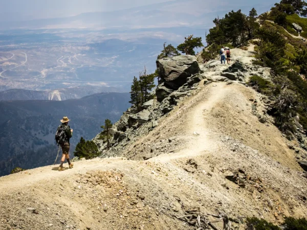
- The Times notes that some segments can be overgrown or more rugged than the mileage suggests, and that hikers should use maps rather than relying only on a phone signal.
- The U.S. Forest Service Angeles National Forest alerts page currently flags high fire danger and an Eaton Fire area closure, so hikers should check the latest official alerts before choosing a route.
- The National Weather Service forecast available during this morning’s check called for generally mild mountain conditions near Red Box and the Arroyo Seco/JPL area, but forecasts can shift quickly.
Why this is useful for LA hikers
The Gabrielino Trail is not a single “one-size-fits-all” hike. That is the appeal. For many Los Angeles hikers, the best use of the route is to pick a segment that matches the group’s fitness, available time and tolerance for elevation gain. A shorter Arroyo Seco approach can still deliver shade, water-side canyon scenery and a mountain feel without a full-day commitment. Red Box-area routes can feel more remote and adventurous, but they also demand more planning, especially if a hike becomes point-to-point.
For a solstice-weekend outing, the best strategy is conservative: start early, carry more water than you expect to drink, bring sun protection, and decide on a turnaround time before the hike begins. Creek water should not be treated as automatically safe to drink. If it is part of your emergency plan, bring a proper filter. Hikers should also assume that cell coverage may be unreliable in canyon sections and should download maps in advance or carry a paper map of Angeles National Forest.
Before you go
Check the official Angeles National Forest alerts page the same day you hike, especially because fire danger and post-fire closures can affect route choices. If parking at Red Box or another developed forest site, confirm whether an Adventure Pass or other federal lands pass is required. Dogs may be allowed on some suggested routes, but owners should account for hot surfaces, limited water, wildlife and narrow trail sections.
The bottom line: this is a worthwhile, timely trail idea for Los Angeles readers because it turns the long daylight window into a practical hiking opportunity. But it should be treated as a route-planning prompt, not as a guarantee that every segment is currently easy, open or suitable for every group.
Sources
- Los Angeles Times: “This great L.A. trail is a perfect place to spend the longest day of the year”
- U.S. Forest Service: Angeles National Forest alerts and notices
- U.S. Forest Service: Angeles National Forest recreation information
- National Weather Service forecast grid near Red Box
- National Weather Service forecast grid near Arroyo Seco/JPL area