Address: 12896 Yerba Buena Road, Malibu
Park features: Restrooms, Dogs On Leash, Easy Hiking, Equestrian, Mountain Biking, Picnic Tables, Parking Lot, Drinking Water
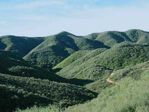
Tucked in the canyons above Malibu and nestled below majestic Boney Mountain, you will find Circle X Ranch. This former Boy Scout camp offers many opportunities for exploration and adventure. Hike to Sandstone Peak, the highest point in the Santa Monica Mountains, and see several of the Channel Islands on a clear day. Enjoy a visit to the Grotto or a creekside picnic. Reserve the Group Camp and listen to coyote songs at night. Travel one of the many trails that wind through this rare coastal Mediterranean ecosystem. The plants you see here, such as coastal sage scrub and mixed chaparral, are adapted to hot, dry summers and mild, wet winters. Keep an eye out for red shank chaparral, a tree-like shrub with reddish-brown bark, clusters of thread-like leaves, and small bunches of white flowers in July and August. From the dry, rocky slopes near Sandstone Peak to the lush fern-studded Grotto, Circle X Ranch provides a wide variety of recreational possibilities. Linger here for a while, and experience the ambiance of this secluded mountain retreat.
Trails & hiking
Featured route: Mishe Mokwa to Tri-Peaks and Sandstone Peak (trail details & live conditions on AllTrails)
- Distance: 7.2 mi (11.6 km) — Loop
- Elevation gain: 1715 ft (523 m), high point 3077 ft
- Difficulty: Strenuous
- Typical time: 4–5 hr
- Rating: 4.8/5 (4,367 AllTrails reviews)
- Good for: Birding, Hiking
- On the trail: Dogs on leash, Views, Wildflowers, Wildlife
Conditions vary by season. Check live weather and air quality on the AllTrails trail page before heading out.
Location
12896 Yerba Buena Road, Malibu
Approximate coordinates: 34.108, -118.93
View on OpenStreetMap
Photos
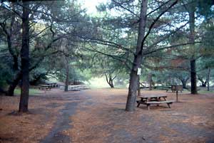


Photo credits: SMMC Archives (1-4)
Related documents
Nearby parks
Park description restored from the 2017 lamountains.com archive (Santa Monica Mountains Conservancy). Trail statistics courtesy of AllTrails. Map data © OpenStreetMap contributors.