The essential takeaway: The Pacific Crest Trail near LA merges desert and mountain landscapes into wild escapes just hours from the city. These top Southern California PCT hikes—from challenging peaks to family-friendly trails—invite eco-conscious adventure. Prioritize water, seasonal timing, and Leave No Trace principles to experience how nature thrives surprisingly close to urban chaos.
Feeling stuck between the urban sprawl of Los Angeles and the craving for wild, meaningful escapes?
The Pacific Crest Trail Los Angeles offers more than just a desert-to-mountain cliché—it’s a gateway to best PCT hikes Southern California where rugged mountains meet desert landscapes in a dance of contrasts. Whether you’re chasing sunrise summit views or family-friendly trails shaded by pine forests, these PCT day hikes near LA blend raw beauty with practical adventure.
Expect insider tips on navigating seasonal shifts, hidden gems like ancient trees and wildflower peaks, and why these routes—steeped in thru-hiker lore—might just redefine your definition of “close to home.”
- The Pacific Crest Trail’s Unique Character in Southern California
- My Top 5 PCT Day Hikes Near Los Angeles
- Difficulty and Preparation
- Best Time to Hike PCT Sections Near Los Angeles
- Practical Information
- Insider Tips
- Essential preparation for your Southern California PCT adventure
- When to hike: navigating the seasons on the SoCal PCT
- Practical logistics and eco-conscious tips for a seamless day
The Pacific Crest Trail’s Unique Character in Southern California
I still remember my first hike on the Pacific Crest Trail near Los Angeles.
After years of trekking through the Andes and Himalayas, I expected a dry, unremarkable stretch near a sprawling city. Instead, I found myself climbing through fragrant chaparral, stumbling upon alpine meadows, and watching condors soar over rugged peaks—just 90 minutes from downtown LA.
This trail isn’t just a path—it’s a living tapestry of desert resilience and mountain grandeur.
The PCT begins at the Mexican border in arid desert landscapes, but quickly transforms as it crosses Southern California.
By the time it reaches the San Gabriel and San Bernardino mountains, the trail offers accessible wilderness with 360-degree views. You’ll hike through pine forests that smell like Peru’s highlands, cross streams where lizards dart over sun-baked rocks, and stand on summits where the contrast between Mojave Desert haze and glittering city lights feels almost surreal.
“There’s a raw, powerful beauty where the desert meets the mountains. It teaches you resilience and reminds you that wild, transformative spaces are often closer than we think.”
These sections reveal the PCT’s dual personality. In spring, wildflowers carpet slopes that turn to snowfields by December—a reminder of Southern California’s seasonal extremes. The trail here avoids technical climbs, favoring ridgelines where you’ll spot cougars prowling below and marmots sunbathing on boulders. For those craving best PCT hikes Southern California with variety, this is where the trail’s magic begins.
While the PCT’s full 2,650-mile span demands months, these mountains offer day hikes with the same soul. Follow the San Gabriel and San Bernardino mountains’ geological drama—where recent fault lines created jagged peaks—and you’ll understand why hikers call this “the wild heart of LA’s backyard.” Just remember: pack water, as streams vanish by August, and the desert’s dry heat lingers even at 9,000 feet.
My Top 5 PCT Day Hikes Near Los Angeles
As a travel writer who’s hiked globally, I’ve learned short hikes can deliver epic experiences.
The Pacific Crest Trail near LA offers day hikes matching multi-day adventures—without heavy gear. These five routes blend unique ecosystems, elevation rewards, and trail culture for families, solo trekkers, and curious newcomers.
| Hike Name | Round-Trip Distance | Elevation Gain | Estimated Time | Best Season |
|---|---|---|---|---|
| Vincent Gap to Baden-Powell Summit | ~8 miles | ~2,800 ft | 4-5 hours | Spring/Fall |
| Cajon Pass to Inspiration Point | ~12 miles | ~2,000 ft | 5-6 hours | Fall/Spring |
| Islip Saddle to Little Jimmy Campground | ~4 miles | ~900 ft | 2-3 hours | Summer/Fall |
| Wrightwood to Blue Ridge Summit | ~7 miles | ~1,500 ft | 3-4 hours | Spring/Summer |
| Big Bear Lake (Onyx Summit Trailhead) | ~6–10 miles | ~1,000–1,500 ft | 3-5 hours | Summer/Fall |
Vincent Gap to Baden-Powell Summit
This 8-mile hike climbs 2,800 feet through pine forests to a 9,406-foot summit. Key highlights: a monument to Lord Baden-Powell and the 1,500-year-old Wally Waldron Tree.
Why I love this hike: The summit connects ancient nature with modern adventure. Pro tip: Pack trekking poles for the descent.
Cajon Pass to Inspiration Point
This 12-mile hike starts at a gas station cluster with the iconic McDonald’s—a PCT resupply legend. The route climbs steadily, offering panoramic San Gabriel views.
Why I love this hike: The golden-arched landmark is a rite of passage. It’s where the PCT’s community spirit shines.
Islip Saddle to Little Jimmy Campground
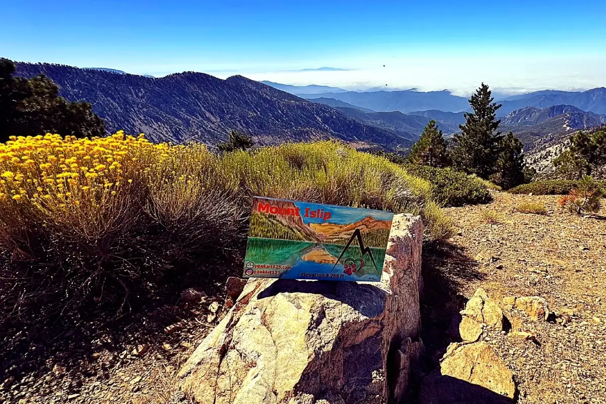
This 4-mile route balances shade and open meadows. The gentle elevation gain suits families and beginners.
Why I love this hike: The campground’s restaurant serves kid-friendly meals and has a play area—nature meets happy kids.
Wrightwood to Blue Ridge Summit
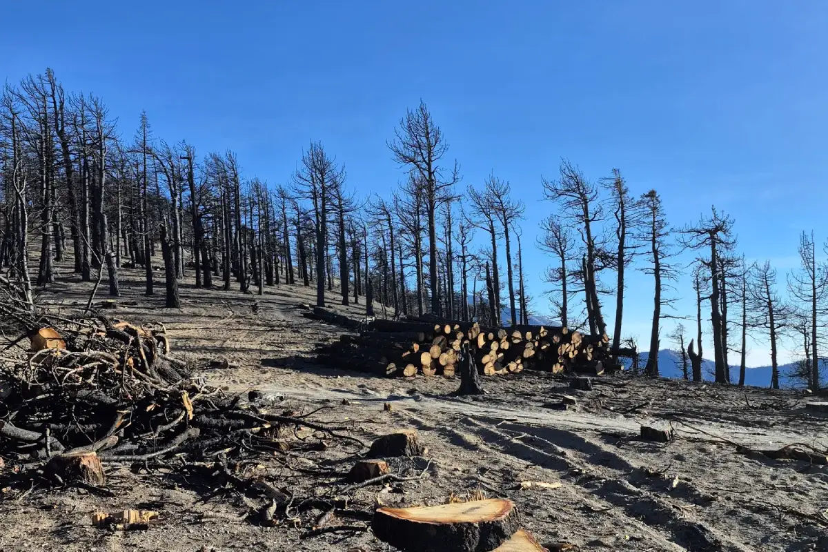
This 7-mile hike starts in Wrightwood, passing ski slopes and meadows. Clear days reveal Mount High Resort lifts below.
Why I love this hike: My go-to “impulse adventure.” The summit’s rock markers feel like a secret handshake for hikers.
Big Bear Lake (Onyx Summit Trailhead)
This 6–10-mile hike near Big Bear Lake combines pine forests with flexible routes. Proximity to amenities makes it ideal for mixed groups.
Why I love this hike: The trail’s ease lets me reward myself with Big Bear’s essentials: craft beer at Big Bear Lodge or a lake swim.
Difficulty and Preparation
Hikes range from moderate to strenuous, with elevations near 9,000 feet. Summer heat demands early starts—sunrise beats 90°F midday temps.
Essential gear includes:
- 3L+ water (desert climates dehydrate quickly)
- UV protection (mountain air intensifies sun exposure)
- Offline maps (cell signals fade off-trail)
For winter/spring, microspikes make icy sections safe. Always leave no trace—protect fragile alpine ecosystems.
Best Time to Hike PCT Sections Near Los Angeles
Spring brings wildflower “superblooms.” Summer’s high elevations stay cool; fall’s crisp air eases climbs. Winter’s snow limits access but offers solitude.
Pro seasons:
- March-May: Wildflowers steal the show
- June-September: Higher elevations stay hikeable
- October-February: Limited below 7,000 feet—check snow reports
Check USFS alerts daily—weather shifts rapidly here.
Practical Information
Trailheads connect via Angeles Crest Highway (CA-2) or State Route 138. No permits needed—just park passes for Angeles National Forest. Gas up in Wrightwood or Big Bear before starting—remote areas lack stations.
Navigation note: PCT white blazes don’t always align with apps. Use Gaia GPS offline maps for reliability.
Insider Tips
Hacks I’ve learned:
- Bring bear-resistant containers—black bears roam higher elevations
- Combine hikes: Link Vincent Gap and Islip Saddle for a weekend “PCT sampler”
- Support eco-tourism: Donate to PCTA for trail upkeep
These tips ensure safety, sustainability, and deeper trail connections.
Essential preparation for your Southern California PCT adventure
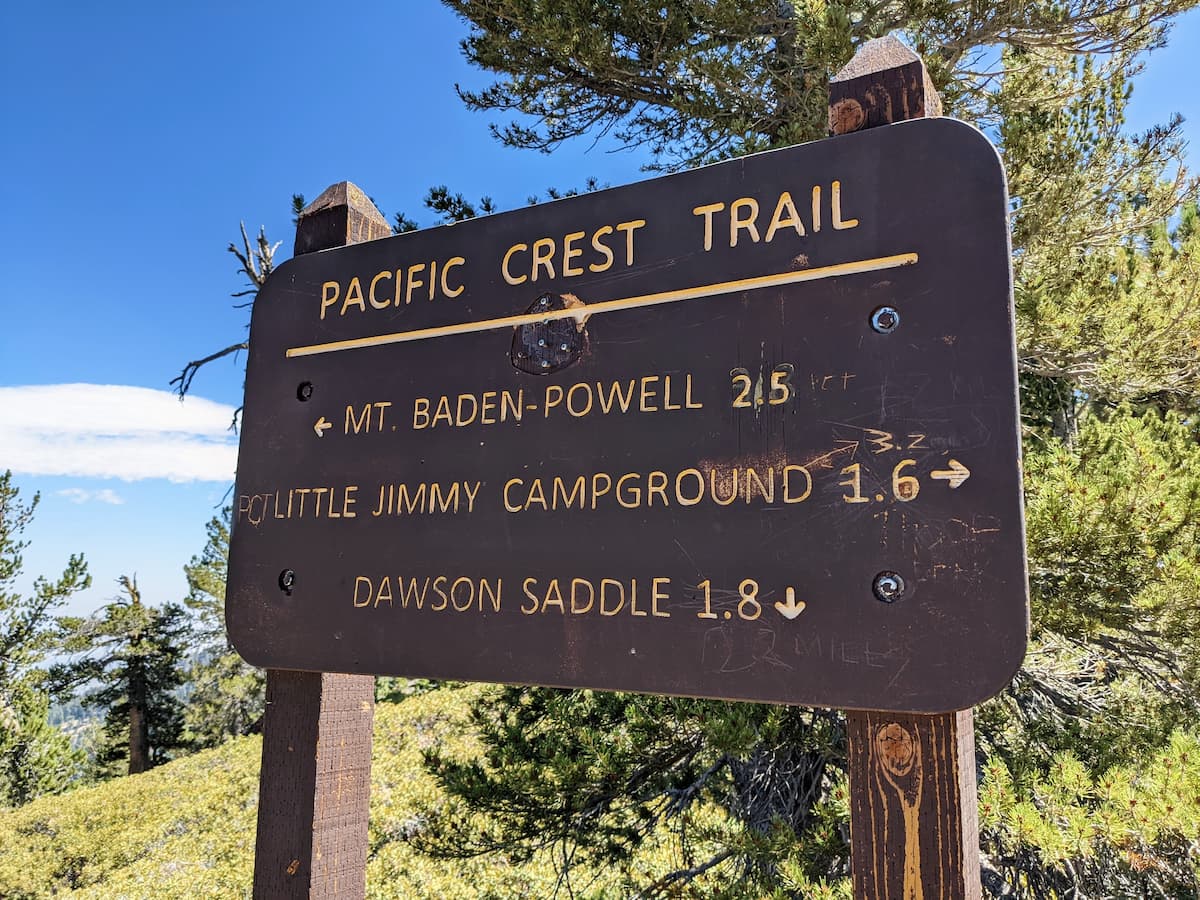
Day hikes on the PCT’s Southern California section demand serious prep. Altitude swings (6,000–9,000 feet), relentless sun, and extreme temperatures challenge even seasoned hikers. Dehydration, heat exhaustion, and wildlife encounters have spoiled perfect hikes for many. These trails test your readiness but reward careful planning with epic views of the LA Basin and San Gabriel peaks.
Water management: lifeblood of Southern California hikes
Carry at least 3 liters per person. Natural sources dry up seasonally—trust the PCT Water Report, a crowdsourced guide updated by hikers. I’ve learned to carry extra water after misjudging San Gabriel’s 100°F (38°C) heat. Hydration reservoirs beat bottles for easy sips on the go.
Sun protection: your invisible armor
UV exposure intensifies above 5,000 feet. Pack a wide-brimmed hat, UPF-rated clothing, and reef-safe sunscreen. Avoid midday hiking—start before 8 AM or after 4 PM. Sunburn here drains energy and worsens dehydration. I’ve burned through SPF 50+ on exposed ridges with zero shade.
Wildlife safety: snakes and plants
Rattlesnakes ambush rodents—and hikers. Back away slowly if spotted. A hiker avoided a Diamondback near Wrightwood by heeding its sunning spot. Keep dogs leashed and watch boulders. Poodle-dog bush, a post-fire invader, causes rashes worse than poison oak. Scrub exposed skin immediately—even long sleeves won’t fully protect you.
- Extra Water Capacity: Minimum 3L/person. Hydration reservoirs recommended.
- Serious Sun Protection: Hat, sunglasses, UPF shirt, SPF 50+ sunscreen.
- Navigation Tools: Download Gaia GPS/AllTrails maps + backup power bank. Cell service fails here.
- First-Aid Kit: Blister care, tweezers, antihistamine.
- Trekking Poles: For steep climbs and checking snake-prone trail sections.
- The 10 Essentials: Carry them even for short hikes—better safe than stranded.
Seasonal considerations
Summer heat turns trails into ovens—stick to higher elevations like Big Bear Lake. Winter demands microspikes for icy sections above 7,000 feet. Spring brings wildflowers and sudden thunderstorms—I’ve bailed twice from electrical storms above 8,000 feet. Morning fog usually clears by 9 AM, but afternoon clouds mean immediate descent.
Eco-conscious hiking: protecting trail magic
Filter water from outlet streams, not alpine lake centers. Outlet streams benefit from natural UV exposure. Pack out waste in cat holes 200 feet from trails. As a mom, I teach “pack in, pack out”—even small trash matters in these ecosystems.
This guide reflects hard-earned lessons. Southern California’s PCT rewards careful preparation with alpine meadows and sweeping vistas. Pack smart, hike safe, and embrace the trail’s demands—they’re what make these day hikes unforgettable. The PCT isn’t just a path—it teaches resilience, one dusty mile at a time.
When to hike: navigating the seasons on the SoCal PCT
Timing transforms the Pacific Crest Trail. Best time to hike near Los Angeles isn’t just about weather—it’s about syncing with nature’s rhythm. Each season paints the San Gabriels and San Bernardinos differently, demanding respect for their moods.
The mountains have their own rhythm. Hiking through the seasons teaches you to listen, to adapt, and to respect their power. Each season offers a completely different trail.
Spring: wildflowers and thaw
Spring (March-May) is magic. Spring wildflowers erupt in goldfields and lupines along the PCT’s lower elevations. Snowmelt fills streams, but higher peaks like Baden-Powell still hold icy patches. I’ve climbed through March slush here, microspikes crunching over crusty snow—worth the gamble for those day hikes near Los Angeles craving both bloom and bite.
Summer: heat and height
Beware summer heat. Cajon Pass becomes an oven, temps hitting 100°F by mid-morning. But altitude redeems the season. At Big Bear’s pine-shaded paths or Baden-Powell’s summit (9,406ft), alpine breezes make afternoons bearable—if you start before dawn. I once hiked Vincent Gap at 5am, chasing the last cool hours before thunderheads rolled in. Lesson? Start early, or not at all.
Fall: crisp air and clarity
Crisp fall air makes September-November ideal. Trails dry, crowds thin, and the PCT reveals hidden textures—ochre meadows near Wrightwood, burnt sienna leaves at Islip Saddle. I’ve navigated October’s first frosts here, breath visible in predawn light, savoring the trail’s quietest, most reflective mood.
Winter: ice and insight
Winter conditions demand courage. Lower elevations stay hikeable, but Baden-Powell’s summit turns into a snow globe. Microspikes become non-negotiable—no crampons needed for day hikers, but don’t underestimate slick ridges. I’ve watched sunrise through snow-laced pines at Little Jimmy Campground, realizing the trail’s rawest beauty emerges when most hikers retreat.
Seasons here aren’t suggestions—they’re survival guides. Pack layers, check snow reports, and remember: the PCT’s soul shifts with the calendar. What you’ll miss if you don’t time it right? A lifetime of views, hidden in plain sight.
Practical logistics and eco-conscious tips for a seamless day
Most PCT trailheads near Los Angeles sit within a 2-hour drive from the city. The Angeles Crest Scenic Byway connects to Vincent Gap and Islip Saddle, where alpine meadows set the stage for epic hikes. Cajon Pass (I-15 north) marks the PCT’s iconic resupply spot at McDonald’s. Wrightwood (Highway 2) and Big Bear Lake (Highway 330) offer direct trail access with mountain-town charm—think cozy coffee shops and spring wildflowers.
No permits required for day hikes, but an Adventure Pass is needed for parking in Angeles National Forest. This small fee supports trail maintenance—essential for summit views. Grab your pass at ranger stations or local stores. Carry a physical map—cell service fades quickly once you leave pavement behind.
- Start at sunrise: Beat the heat and witness golden-hour magic. I’ve watched mule deer sip from streams at dawn—a moment worth the early alarm.
- Check conditions: Use AllTrails or PCT Association updates. Last spring, a last-minute check revealed washed-out bridges near Islip Saddle—saving us from a detour.
- Embrace the thru-hiker spirit: Share a smile or “happy trails” with springtime hikers. Their stories at Cajon Pass—like a hiker finding a lost dog near Wrightwood—keep the trail’s soul alive.
- Pack out trash: As a mother, I prioritize leaving trails cleaner. My kids collect litter on hikes—turning cleanup into a game.
These mountains demand stewardship. The PCT’s beauty thrives through Leave No Trace principles, adapted for Southern California:
- Plan Ahead: Check fire restrictions—dry summers prohibit campfires in some areas.
- Travel on Durable Surfaces: Protect fragile desert and alpine ecosystems.
- Pack It In, Pack It Out: Biodegradable items attract wildlife—carry a trash bag.
- Leave What You Find: Resist pocketing pinecones or wildflowers.
- Minimize Campfire Impacts: Use stoves in designated zones.
- Respect Wildlife: Use bear-proof containers in Big Bear Lake.
- Be Considerate: Step aside for hikers carrying weeks of gear.
Winter requires microspikes; summer demands hydration. I carry a 3-liter bladder and rain jacket. Last July, a sudden thunderstorm near Baden-Powell Summit turned trails muddy—proof of unpredictable weather. Share the trail with mule deer, not litter. When my kids ask why we hike, I want them to experience trails exactly as I found them—untouched, timeless. Because every generation deserves wild spaces, not plastic bags.
The Pacific Crest Trail near LA isn’t merely a hike—it’s a journey through desert-mountain contrasts, blending challenge and wonder just hours from the city. Southern California trails demand preparation but reward effort. Walk mindfully: accessible wilderness here merges peaks and arid beauty, where respect meets curiosity. The PCT’s magic? Its raw, transformative duality—wildness close to home.
FAQ
What makes the Pacific Crest Trail stand out for day hikers near Los Angeles?
The PCT near LA isn’t just about hiking—it’s a journey through stark contrasts. I’ll never forget my first time hiking Baden-Powell Summit. Starting in chaparral, climbing through ancient pine forests, and suddenly emerging into alpine grandeur—it felt like discovering a secret world just hours from the city. For day hikers, this stretch offers the thrill of rugged mountain views and desert vistas without needing weeks to experience it. The key is choosing the right section—like the 8-mile Vincent Gap to Baden-Powell route, where I’ve spotted mule deer at sunrise and watched fog roll over the San Gabriel Mountains like liquid silver. These trails remind me why I fell in love with mountain travel: they’re accessible yet wild, challenging yet deeply rewarding.
Did Reese Witherspoon hike the PCT for the movie adaptation of “Wild”?
While Reese Witherspoon’s portrayal of Cheryl Strayed’s journey captured hearts globally, she didn’t hike the entire PCT for filming. As someone who’s guided trekkers through South American trails, I understand the limitations of movie production timelines. Most filming occurred on specific iconic sections—like parts of California’s desert trails and Oregon’s lush forests. The real magic? The film reignited interest in the PCT, bringing more hikers to these landscapes. I’ve met countless people inspired by “Wild” who now explore day hikes near LA, proving storytelling can connect us to wild places in powerful ways.
Is it possible to enjoy the PCT through day hikes rather than multi-month treks?
Absolutely—this is what makes the PCT special. When my kids were toddlers, I rediscovered the joy of day hiking these trails. The SoCal section offers perfect bite-sized adventures: a 4-mile loop near Islip Saddle for family outings, or a sunrise-to-summit push on Baden-Powell. These aren’t just shortcuts—they’re complete experiences. I love how the trail meets you where you are, whether you’re chasing wildflowers in spring or stargazing by your car after a sunset hike. You’ll get the essence of the PCT’s magic without needing a 5-month sabbatical.
Which part of the PCT poses the greatest challenges for hikers?
Having crossed both Andean passes and Himalayan trails, I’d say the Sierra Nevada section tests even seasoned adventurers. Imagine navigating 40-mile stretches with 12,000-foot passes and lingering snowfields in June—conditions that demand ice axes and route-finding skills. But here’s what resonates with me personally: the Mojave Desert segment. As a mother who values careful planning, I appreciate how it teaches humility. One summer, I underestimated the 100°F heat during a 20-mile stretch between Kennedy Meadows and Tehachapi. Lesson learned? The desert doesn’t care about your backpacking résumé. Both sections require preparation worthy of alpine expeditions.
What are the three most iconic long-distance hiking trails in the US?
The “Triple Crown” of hiking includes the Appalachian Trail (2,190 miles from Georgia to Maine), the Continental Divide Trail (3,100 miles from New Mexico to Montana), and our beloved PCT. As someone who’s guided on Peru’s Salkantay Trek, I find the PCT particularly compelling—it’s not just about distance but diversity. The AT’s relentless rocks and CDT’s remote wilderness have their charms, but the PCT delivers everything: deserts, volcanic ridges, and alpine meadows. For day hikers, it’s like sampling a tasting menu of American landscapes—all within reach of LA’s urban sprawl.
Why do people call the Pacific Crest Trail America’s ultimate hiking experience?
Calling it the “number one” hike feels reductive, but the PCT’s magic lies in its storytelling. When I first read “Wild,” I related to Cheryl’s journey as a woman navigating both external challenges and inner landscapes. The trail’s 2,650-mile span from Mexico to Canada crosses 24 national forests and 7 national parks—a geographic diversity few trails match. For day hikers, even a 3-hour jaunt on Wrightwood’s pine-dappled trails captures the essence: connecting with wild spaces that have shaped countless personal journeys, from thru-hikers to weekend adventurers.
Why didn’t Cheryl Strayed complete the entire Pacific Crest Trail?
Cheryl’s story isn’t about mileage—it’s about transformation. She hiked 1,100 miles from the Mojave Desert to the Columbia River, a third of the PCT. As a mother who balances parenthood with my own adventures, I deeply respect this. When she started in 1995, the PCT wasn’t the well-established route it is today. Her 94-day journey was about healing, not ticking off boxes. Every time I hike the PCT near LA, I remember her words about carrying both physical and emotional burdens. Isn’t that the truth of all meaningful journeys?
How long does a full PCT thru-hike typically take?
Most hikers spend 5-6 months, averaging 15-25 miles daily. When I led groups through Patagonia’s W Trek, I saw how endurance changes when you’re moving day after day. The PCT’s logistics are similar but amplified—desert water carries, Sierra snowpack, and the inevitable resupply waits in towns like Kennedy Meadows. For day hikers, the beauty lies in micro-adventures: that 6-mile round-trip to Inspiration Point where you’ll see through-hikers with their weathered boots and sun-bleached shirts. They’re living proof that big journeys start with small, intentional steps—even if yours ends at your car by sunset.
Is solo hiking on the Pacific Crest Trail safe for women?
As a woman who’s hiked solo in Peru’s Cordillera Blanca and now explores trails with baby carriers, I approach this carefully. The PCT’s remote stretches demand preparation, but so do any wild spaces. My safety mantra? “Be seen, be heard, be prepared.” I always share my GPS tracker with my partner and carry a satellite communicator—tools I wish I’d had during my early travels. The trail’s community matters too: I’ve met more kindred spirits on the PCT than anywhere else. Just last fall, a solo hiker near Big Bear shared tea with me during a sudden snow flurry. The trail takes care of those who respect it.