Address: 13877 Glenoaks Blvd., Sylmar
Park features: Dogs On Leash, Easy Hiking, Equestrian, Mountain Biking, City Views, Picnic Tables, Parking Lot, Filming Location
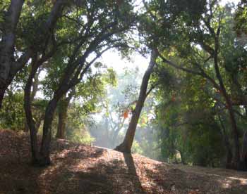
Accessed from the City of Los Angeles’ Stetson Ranch Park in Sylmar, the Saddletree Ranch Trailhead provides shady picnic grounds, an interpretive display, and views into the San Fernando Valley and Angeles National Forest. Popular with equestrians and hikers, Saddletree Ranch Trail connects Conservancy owned Wilson Canyon Park to Los Angeles City maintained trail at Cascades golf course. The trail is part of the interregional Marge Feinberg Rim of the Valley Trail. Feinberg’s tireless volunteer efforts led to legislation that designated the Rim of the Valley Trail Corridor in the Santa Monica Mountains Conservancy Zone. The Corridor was created to form an interlinking system of parks, trails, open space, wildlife habitat, and recreational opportunities within and between the Santa Monica, Santa Susana and San Gabriel Mountains. The Rim of the Valley Trail Corridor lays out the blueprint for a system of natural lands that shelters wildlife and extends recreational opportunities throughout a large urban area. The backbone of that system—and the thread which will one day tie it together, is the Marge Feinberg Rim of the Valley Trail.
Trails & hiking
Featured route: Bee Canyon Trail (trail details & live conditions on AllTrails)
- Distance: 3.4 mi (5.5 km) — Out & back
- Elevation gain: 1075 ft (328 m), high point 1801 ft
- Difficulty: Moderate
- Typical time: 2–2.5 hr
- Rating: 4.4/5 (234 AllTrails reviews)
- Good for: Hiking, Mountain biking, Trail running, Horseback riding
- On the trail: Dogs on leash, Views, Wildflowers, Wildlife
Conditions vary by season. Check live weather and air quality on the AllTrails trail page before heading out.
Location
13877 Glenoaks Blvd., Sylmar
Approximate coordinates: 34.317, -118.407
View on OpenStreetMap
Photos

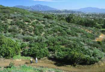
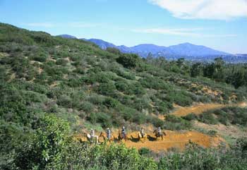
Photo credits: Karin Mueller (1-3)
Related documents
Nearby parks
Park description restored from the 2017 lamountains.com archive (Santa Monica Mountains Conservancy). Trail statistics courtesy of AllTrails. Map data © OpenStreetMap contributors.