
Address: The parking lot is located on the northwest corner of San Gabriel Blvd. and Rosemead Blvd.
Park features: Restrooms, Dogs On Leash, Easy Hiking, Equestrian, Mountain Biking, Picnic Tables, Parking Lot, Filming Location, Drinking Water, ADA Accessible
Bosque del Rio Hondo, located within the Whittier Narrows Recreation Area just one mile south of the 60 Freeway, offers year-round trail access to one of the remaining natural streambeds of the Rio Hondo, as well as seasonal creeks, picnic areas, access to bike paths and equestrian trails, parking facilities, and restroom facilities. The park design visually integrates the natural riverfront with the adjacent land to provide a riverfront setting for passive recreation. A continuing program of native revegetation has restored the river ecology and improved habitat for resident and migratory birds. The design of the developed area was inspired by the San Gabriel Mission, the original site of which was immediately across the river from the park. The park serves as a major staging area for two regional bike paths which run along the San Gabriel River and the Rio Hondo. The area surrounding the Bosque del Rio Hondo is rich in history. The Tongva people arrived in this area 1,000 years before the Spanish missionaries. The Tongva built their homes from willow branches and brushes that grew along the river. They hunted and fished along the banks, and gathered acorns, plants, berries, and roots. The Bosque del Rio Hondo trail system is part of the Juan Bautista de Anza National Historic Trail, which commemorates the route taken by de Anza in 1771-76 when he led a group of colonists from Sonora, Mexico to establish a Spanish settlement at San Francisco Bay. The expedition included 240 people (half of whom were children who later returned to settle Los Angeles) and over 1,000 head of stock. The trail covers over 1,200 miles from Mexico, through Arizona and up into Northern California, honoring one of history's great migratory marches. The Rio Hondo is part of a river system responsible for draining much of L.A. County's watershed, and plays a critical role as part of the Whittier Narrows Flood Control Basin.
Trails & hiking
Featured route: Whittier Narrows Nature Center Loop and San Gabriel River Trail (trail details & live conditions on AllTrails)
- Distance: 4.2 mi (6.8 km) — Loop
- Elevation gain: 45 ft (14 m), high point 285 ft
- Difficulty: Easy
- Typical time: 1–1.5 hr
- Rating: 3.4/5 (28 AllTrails reviews)
- Good for: Birding, Hiking, Trail running
- On the trail: Dogs on leash, Rivers, Wildflowers, Wildlife
Conditions vary by season. Check live weather and air quality on the AllTrails trail page before heading out.
Location
The parking lot is located on the northwest corner of San Gabriel Blvd. and Rosemead Blvd.
Approximate coordinates: 34.026, -118.06
View on OpenStreetMap
Photos
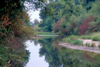
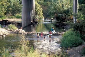
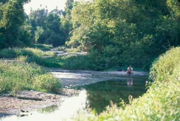
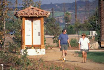
Photo credits: SMMC Archives (1-4)
Related documents
Nearby parks
Park description restored from the 2017 lamountains.com archive (Santa Monica Mountains Conservancy). Trail statistics courtesy of AllTrails. Map data © OpenStreetMap contributors.


