Address: 24255 The Old Road, Newhall
Phone: (661) 255-3606
Park features: Restrooms, Dogs On Leash, Easy Hiking, Equestrian, Mountain Biking, Picnic Tables, Parking Lot, Filming Location, Nature Center, Drinking Water, ADA Accessible, Event Facilities, Wedding Venue, Historical Sites
Santa Clarita Woodlands Park On the north-facing flank of the Santa Susana Mountains, the numerous canyons of Santa Clarita Woodlands Park contain globally unique combinations of tree species, perennial streams, spring wildflower displays, and abundant wildlife. Even black bears and mountain lion roam here–only a few miles away from the urbanized San Fernando and Santa Clarita Valleys. These 4,000 acres of public parkland are a critical component of a cross-mountain range wildlife habitat corridor that links the Santa Monica Mountains to the Angeles and Los Padres National Forests. East and Rice Canyons East and Rice Canyons are home to the Santa Clarita Woodlands’ richest and lushest vegetation. The trailhead provides parking, restrooms, and a picnic area. A hike on the 3.8 mile East Canyon trail takes one through three species of oak, California bay laurel, California black walnut, and bigleaf maple, up in elevation to a unusual forest of bigcone Douglas fir. Found at a relatively low elevation, this species is more ideally suited to the climatic regime of 18,000 years ago. The dirt fire road leads hikers, mountain bikers and equestrians on a steady climb to magnificent views of Santa Clarita Woodlands Park and the Santa Clarita Valley. The trail leads into the over 400-acre Michael D. Antonovich Open Space which straddles the ridgeline of the Santa Susana Mountains. At the top of East Canyon, the trail joins the Marge Feinberg Rim of the Valley Trail where it intersects the Weldon Canyon Motorway and trails from Bee Canyon and O’Melveny Park Rice Canyon Loop Trail is an easy to moderate 1.2 mile trail along Rice Creek for hikers only. The trail crosses the creek several times. The trail wanders through a grassy open slope to a viewpoint. Watch for the natural oil seeps streamside near the end of the trail. Directions to the trailhead: From the Golden State (I-5) freeway in Santa Clarita, exit Calgrove Blvd. Turn west as Calgrove becomes the Old Road and head south .9 mile to parking on the west side of the road. Ed Davis Park in Towsley Canyon Ed Davis Park in Towsley Canyon , named for former State Senator Ed Davis, who championed the preservation of Towsley Canyon, offers visitors a peaceful haven just west of the I-5 between the Santa Clarita and San Fernando Valleys. Trails for hiking, mountain biking, and equestrian use lead visitors through an astonishing variety of habitat types. Notable park features include spectacular water-worn rock formations in Towsley Gorge, year-round Towsley Creek, scenic trail viewpoints and oak woodland. Sonia Thompson Nature Center features exhibits about the natural and cultural history of the park. Towsley Lodge is a beautiful Spanish-style ranch house that sits atop a large green knoll surrounded by cottonwoods. The lodge is available for private day or overnight group rental. It provides a wonderful staging area for all types of events from corporate meetings to weddings to overnight slumber parties. There are two large living rooms with commodious furnishings and wood-burning fireplaces, and a fully equipped kitchen. Upstairs, three bedrooms provide overnight accommodations for up to 18 guests. A large backyard area includes an outdoor patio with a fire pit and an azure swimming pool. Pico Canyon Located in the north end of Santa Clarita Woodlands Park, Pico Canyon was the site of the first commercially successful oil well in the western United States—Pico No 4. Today the canyon offers hikers, bikers, and equestrians not only a glimpse of California history, but shaded trails into the rugged and lushly vegetated headwaters of Pico Canyon, and the Santa Susana Mountains. Trails into the backcountry are accessed from a paved road leading out of Mentryville. Mentryville Located at the base of Pico Canyon’s chaparral-dominated slopes, Mentryville was an 1880’s oil boom town built around Pico No. 4. Named for Charles Alexander Mentry, the oil well’s tenacious driller–and later superintendent of the company that would become Chevron—Mentryville was home to over 100 families until the early 1930’s. Pico No. 4 went on to become the longest continually operating oil well in the world, closing in 1990. Historic buildings still stand including Charles Mentry’s grand thirteen-room mansion, a one-room school house, and a period barn. Pico No. 4 are registered as California State Historical Landmarks. Trained volunteers are available on the 1st and 3rd Sundays of the month from 12 to 4 p.m. to lead interpretive tours of the historical grounds and buildings. Directions: From the Golden State Freeway (I-5) in Valencia, exit on Lyons Road/ Pico Canyon Road. Head west on Pico Canyon Road. Nears its end, bear left at a Y and continue to the end of the road. A large parking lot is opposite historic Mentryville.
Trails & hiking
Featured route: Towsley Canyon Loop Trail (trail details & live conditions on AllTrails)
- Distance: 6.2 mi (10.0 km) — Loop
- Elevation gain: 1459 ft (445 m), high point 2483 ft
- Difficulty: Moderate
- Typical time: 3.5–4 hr
- Rating: 4.7/5 (4,864 AllTrails reviews)
- Good for: Birding, Hiking, Mountain biking, Trail running
- On the trail: Dogs on leash, Forests, Rivers, Views, Wildflowers, Wildlife
Conditions vary by season. Check live weather and air quality on the AllTrails trail page before heading out.
Location
24255 The Old Road, Newhall
Approximate coordinates: 34.3765, -118.5715
View on OpenStreetMap
Photos

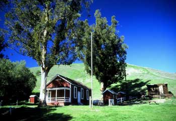
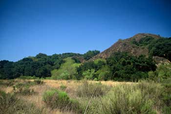
Photo credits: Craig Collins (1, 4) , Karin Mueller (2-3)
Related documents
Nearby parks
Park description restored from the 2017 lamountains.com archive (Santa Monica Mountains Conservancy). Trail statistics courtesy of AllTrails. Map data © OpenStreetMap contributors.