Address: 24255 The Old Road, Newhall
Park features: Restrooms, Dogs On Leash, Easy Hiking, Equestrian, Mountain Biking, Picnic Tables, Parking Lot, Filming Location, Drinking Water, ADA Accessible
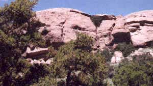
East and Rice Canyons are home to the Santa Clarita Woodlands’ richest and lushest vegetation. The trailhead provides parking, restrooms, and a picnic area. A hike on the 3.8 mile East Canyon trail takes one through three species of oak, California bay laurel, California black walnut, and bigleaf maple, up in elevation to a unusual forest of bigcone Douglas-fir. Found at a relatively low elevation, this species is more ideally suited to the climatic regime of 18,000 years ago. The dirt fire road leads hikers, mountain bikers, and equestrians on a steady climb to magnificent views of Santa Clarita Woodlands Park and the Santa Clarita Valley. The trail leads into the 500-acre Michael D. Antonovich Open Space Preserve which straddles the ridgeline of the Santa Susana Mountains. At the top of East Canyon, the trail joins the Marge Feinberg Rim of the Valley Trail where it intersects the Weldon Canyon Motorway and other trails from Bee Canyon and O’Melveny Park. Rice Canyon Loop Trail is an easy to moderate 1.2 mile trail along Rice Creek for hikers only. The trail crosses the creek several times and wanders through a grassy open slope to a viewpoint. Watch for the natural oil seeps streamside near the end of the trail. Directions to the trailhead: From the Golden State (I-5) freeway in Santa Clarita, exit Calgrove Blvd. Turn west as Calgrove becomes the Old Road and head south .9 mile to parking on the west side of the road.
Trails & hiking
Featured route: East Canyon and Rice Canyon Trail (trail details & live conditions on AllTrails)
- Distance: 6.5 mi (10.5 km) — Out & back
- Elevation gain: 1309 ft (399 m), high point 2208 ft
- Difficulty: Moderate
- Typical time: 3–3.5 hr
- Rating: 4.5/5 (178 AllTrails reviews)
- Good for: Birding, Hiking, Mountain biking, Trail running, Walking
- On the trail: Dogs on leash, Forests, Views, Wildflowers, Wildlife
Conditions vary by season. Check live weather and air quality on the AllTrails trail page before heading out.
Location
24255 The Old Road, Newhall
Approximate coordinates: 34.392, -118.597
View on OpenStreetMap
Photos

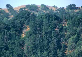
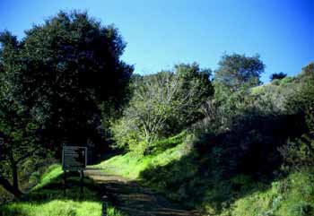
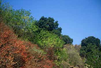
Photo credits: Karin Mueller (1-4)
Related documents
Nearby parks
Park description restored from the 2017 lamountains.com archive (Santa Monica Mountains Conservancy). Trail statistics courtesy of AllTrails. Map data © OpenStreetMap contributors.