Address: 5700 Greenleaf Avenue, Whittier (address for mapping purposes only)
Park features: Dogs On Leash, Easy Hiking, Equestrian, City Views, Parking Lot
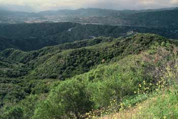
Located in the Puente Hills, and managed by the Puente Hills Habitat Preservation Authority, Hellman Park offers trails into some of the most beautiful habitat in the area. Hike the trails on either side of the reservoir. Both trails are very aerobic up the mountainside taking you on a loop trail to the ridgeline overlooking Sycamore Canyon, a beautiful view. Along the way you will see a large collection of California brittlebush, a Sunflower family member with large yellow flowers in the spring. On a good day Catalina Island and downtown Los Angeles are observable. Directions: From the 605 Freeway, exit Rose Hills Road and head east. Turn right onto Workman Mill Road past Sycamore Park and head south onto Beverly Blvd. Turn left on Greenleaf Avenue. The entrance to Hellman Wilderness Park will be on your right. Parking: Park in the lot on Greenleaf Avenue.
Trails & hiking
Featured route: Peppergrass to Rattlesnake Ridge West Trail (trail details & live conditions on AllTrails)
- Distance: 5.2 mi (8.4 km) — Out & back
- Elevation gain: 1302 ft (397 m), high point 1407 ft
- Difficulty: Moderate
- Typical time: 2.5–3 hr
- Rating: 4.6/5 (1,873 AllTrails reviews)
- Good for: Hiking, Trail running
- On the trail: Views, Wildflowers, Wildlife
Conditions vary by season. Check live weather and air quality on the AllTrails trail page before heading out.
Location
5700 Greenleaf Avenue, Whittier (address for mapping purposes only)
Approximate coordinates: 33.985, -118.044
View on OpenStreetMap
Photos

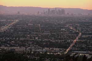
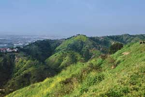
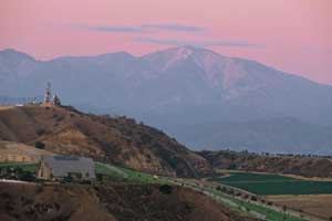
Photo credits: Craig Collins (1-4)
Related documents
Nearby parks
Park description restored from the 2017 lamountains.com archive (Santa Monica Mountains Conservancy). Trail statistics courtesy of AllTrails. Map data © OpenStreetMap contributors.