Address: Mulholland Hiighwway W. of Kanan Road, Malibu
Park features: Restrooms, Dogs On Leash, Easy Hiking, Equestrian, Mountain Biking, Picnic Tables, Parking Lot, Drinking Water, ADA Accessible
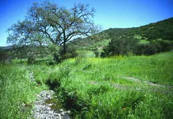
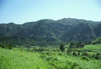
As you drive along Mulholland Highway or Kanan Road, you could easily miss Rocky Oaks. Hidden between houses, roads and other signs of modern life, Rocky Oaks is home to a surprising number of plants and animals. Its fewer than 200 acres contain a diversity of wildlife habitats including a pond, oak woodland, grassland, coastal sage scrub and chaparral communities. For thousands of years, Rocky Oaks provided people with food, shelter and materials. Ancestors of today’s Chumash survived on the abundant resources of the land, hunting animals and harvesting plants. European settlers brought agriculture to this area. The stock pond and much of the grassland habitat are remnants of that life-style. Agricultural operations at Rocky Oaks ended with the 1978 Kanan Fire. Today, Rocky Oaks serves as a refuge for wildlife. Rocky Oaks is an undeveloped space in which animals can find food and shelter. It helps connect the habitats that make up the Santa Monica Mountains and allows animals to travel and rest. Rocky Oaks also gives its human guests a place to relax, picnic, stroll, view wildlife or introduce young hikers to the outdoors.
Trails & hiking
Featured route: Rocky Oaks Pond Trail (trail details & live conditions on AllTrails)
- Distance: 1.4 mi (2.3 km) — Loop
- Elevation gain: 173 ft (53 m), high point 990 ft
- Difficulty: Easy
- Typical time: 0.5–1 hr
- Rating: 4.0/5 (287 AllTrails reviews)
- Good for: Hiking
- On the trail: Dogs on leash, Kid-friendly, Views, Wildflowers, Wildlife
Conditions vary by season. Check live weather and air quality on the AllTrails trail page before heading out.
Location
Mulholland Hiighwway W. of Kanan Road, Malibu
Approximate coordinates: 34.124, -118.835
View on OpenStreetMap
Photos

Related documents
Nearby parks
Park description restored from the 2017 lamountains.com archive (Santa Monica Mountains Conservancy). Trail statistics courtesy of AllTrails. Map data © OpenStreetMap contributors.