Address: Las Virgenes Road south of Mulholland Highway, Calabasas
Phone: (818) 880-0367
Park features: Restrooms, Easy Hiking, Equestrian, Mountain Biking, Picnic Tables, Parking Lot, Nature Center, Drinking Water, ADA Accessible, Historical Sites
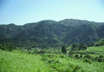
Just 25 miles from downtown Los Angeles, the park has over 4,000 acres, featuring hiking, fishing, bird watching and horseback riding opportunities. There are 15 miles of streamside trail through oak and sycamore woodlands and chaparral-covered slopes. Twenty-five-mile Malibu Creek in the park is the principal water-course of the Santa Monica Mountains – from Boney Mountain to Malibu Lagoon. The park was the center of Chumash Native American life for centuries and was once used to film numerous movies and TV shows, such as Planet of the Apes and M*A*S*H. Operating Hours: dawn to dusk. A visitor center is open on weekends only. Directions: The park is located four miles south of Highway 101 on Las Virgenes/Malibu Canyon Road.
Trails & hiking
Featured route: Rock Pool and Century Lake Trails (trail details & live conditions on AllTrails)
- Distance: 4.5 mi (7.2 km) — Out & back
- Elevation gain: 331 ft (101 m), high point 791 ft
- Difficulty: Easy
- Typical time: 1.5–2 hr
- Rating: 4.6/5 (6,438 AllTrails reviews)
- Good for: Birding, Hiking, Rock climbing, Trail running, Horseback riding
- On the trail: No dogs, Kid-friendly, Forests, Lakes, Rivers, Views, Wildflowers, Wildlife
Conditions vary by season. Check live weather and air quality on the AllTrails trail page before heading out.
Location
Las Virgenes Road south of Mulholland Highway, Calabasas
Approximate coordinates: 34.097, -118.713
View on OpenStreetMap
Photos

Nearby parks
Park description restored from the 2017 lamountains.com archive (Santa Monica Mountains Conservancy). Trail statistics courtesy of AllTrails. Map data © OpenStreetMap contributors.