Address: Intersection of Las Virgenes Road and Mulholland Highway, Calabasas
Park features: Dogs On Leash, Easy Hiking, Equestrian, Mountain Biking, Parking Lot, Filming Location, Drinking Water
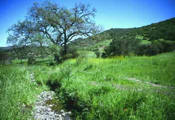
Located in the heart of the Santa Monica Mountains at the intersection of Las Virgenes Road and Mulholland Highway in Calabasas, 696-acre Las Virgenes View Park is a joint project of the City of Calabasas, the Las Virgenes Municipal Water District, and the Conservancy. Amenities include trails, interpretive kiosks, benches, and a drinking fountain. Trails The Las Virgenes View Trail: 2.4 miles, easy. The trail climbs through a landscape of chaparral, oak woodland, and a riparian zone highlighted by sycamore, black cottonwood, willow and bay. A rare native valley grassland contains purple needle grass, and blue-eye grass. Hikers, mountain bikers, and equestrians can wind their way up to scenic vistas at an elevation of 1,100 feet. Spectacular, 360-degree views from the top of the trail include Malibu Creek State Park, Stokes Canyon, Saddle Peak, Goat Buttes, and Lady Face Mountain. The northern trailhead, marked by an informational kiosk, heads deep into the northern part of the park and connects with an existing trail. Directions: From the 101 Freeway in Calabassas, exit on Las Virgenes Road. Head south to Mulholland Highway. The park entrance, parking, and trailhead are on the northeast corner.
Trails & hiking
Featured route: Las Virgenes View Loop Trail (trail details & live conditions on AllTrails)
- Distance: 2.0 mi (3.2 km) — Loop
- Elevation gain: 374 ft (114 m), high point 1306 ft
- Difficulty: Moderate
- Typical time: 1–1.5 hr
- Rating: 4.5/5 (432 AllTrails reviews)
- Good for: Hiking, Mountain biking, Trail running
- On the trail: Dogs on leash, Views, Wildflowers, Wildlife
Conditions vary by season. Check live weather and air quality on the AllTrails trail page before heading out.
Location
Intersection of Las Virgenes Road and Mulholland Highway, Calabasas
Approximate coordinates: 34.1265, -118.717
View on OpenStreetMap
Photos
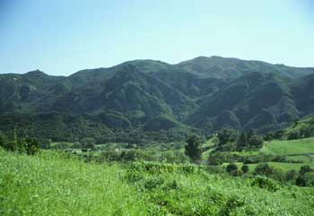
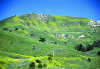
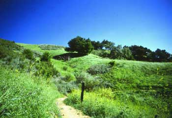
Photo credits: Karin Mueller (1-3)
Nearby parks
Park description restored from the 2017 lamountains.com archive (Santa Monica Mountains Conservancy). Trail statistics courtesy of AllTrails. Map data © OpenStreetMap contributors.