Address: Pacific Coast Highway to S. end of Westward Beach Road, Malibu
Phone: (818) 880-0350
Park features: Restrooms, Easy Hiking, Parking Lot, Drinking Water
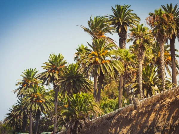
Point Dume State Preserve features headlands, cliffs, rocky coves and vast beach access. The beach is presently operated by Los Angeles County, which also operates Zuma County Beach. These facilities are noted for swimming, surfing, scuba diving and fishing. Point Dume is a perfect place to watch for California gray whales during the December – March migration period. At the end of Westward Beach Road, access to Point Dume State Preserve begins from the cul-de-sac. A gradual ascending trail leads to an ancient coastal bluff sand dune. Visitors are asked to stay on the trail in an effort to help reserve this unique sand accumulation. An incredible view encompassing the entire Santa Monica Bay, north Malibu Coast, inland Santa Monica Mountains and distant Catalina Island may be enjoyed from the top on a clear day. A boardwalk, just below the summit, leads to a viewing platform – it tends to be more sheltered on a windy day. A stairway from the east side of the bluff-top preserve allows access to a more isolated beach and fine tide- pooling opportunities. Some disabled parking is available along Cliffside Drive, adjacent to the bluff-top park area. For viewing platform access, negotiating a slight grade will be necessary. Directions: From Santa Monica follow Pacific Coast Highway 18-miles west to Westward Beach Road. Turn toward the ocean, go beyond the fee collection station to the very end of the road. From the 101-Freeway, exit at Kanan Road, follow it south 12-miles to Pacific Coast Highway, then turn right. Westward Beach Road is over the rise, at the foot of the hill.
Trails & hiking
Featured route: Point Dume Cove Trail (trail details & live conditions on AllTrails)
- Distance: 1.1 mi (1.8 km) — Out & back
- Elevation gain: 213 ft (65 m), high point 213 ft
- Difficulty: Moderate
- Typical time: 0.5–1 hr
- Rating: 4.8/5 (1,583 AllTrails reviews)
- Good for: Hiking, Rock climbing
- On the trail: No dogs, Kid-friendly, Beaches, Views, Wildflowers, Wildlife
Conditions vary by season. Check live weather and air quality on the AllTrails trail page before heading out.
Location
Pacific Coast Highway to S. end of Westward Beach Road, Malibu
Approximate coordinates: 34.001, -118.806
View on OpenStreetMap
Photos

Related documents
Nearby parks
Park description restored from the 2017 lamountains.com archive (Santa Monica Mountains Conservancy). Trail statistics courtesy of AllTrails. Map data © OpenStreetMap contributors.