The San Gabriel Mountains offer diverse elevations ranging from the 3.08-mile Rose Bowl Loop to the 5,603-foot summit of Mount Lowe. Pasadena serves as a primary gateway to these varied terrains, providing accessible trails for daily fitness and technical high-altitude climbs.
Finding the right path is complicated by the current closure of Eaton Canyon Trail until December 2027 due to post-fire instability. This guide details the best hiking trails near Pasadena to help you navigate active routes and seasonal safety requirements effectively.
- Best Hiking Trails Near Pasadena: Logistics and Selection Criteria
- Rose Bowl Loop: 3 Miles of Paved Fitness
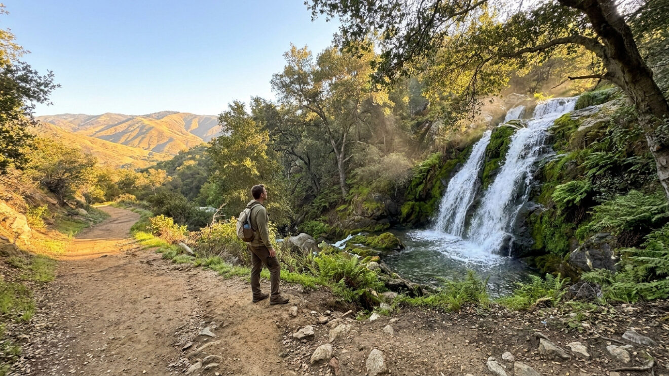
- Millard Canyon Falls: Short Shaded Trek to Waterfalls
- Eaton Canyon Falls: The Iconic San Gabriel Valley Hike
- 6 Miles of History at the Echo Mountain Ruins
- Mount Lowe Peak: Summit Views and High-Altitude Swings
- Henninger Flats: Challenging Climb to a Forest Nursery
Best Hiking Trails Near Pasadena: Logistics and Selection Criteria
Pasadena hiking ranges from the flat 3-mile Rose Bowl Loop to the 5,603-foot Mount Lowe summit. Essential gear includes a $5 Adventure Pass for National Forest trailheads and high-capacity hydration for exposed, high-elevation climbs. These logistical requirements ensure safe access to the best hiking trails near Pasadena for every skill level.
Winter rains cause rockslides and debris flows; check Forest Service website for fire recovery zone closures.
Current Trail Status and Seasonal Hydrology
Winter rains transform dry creek beds into active streams. Heavy downpours often trigger rockslides or debris flows. Check recent weather reports before heading out. Always verify trail openings via the Forest Service website as fire recovery zones remain strictly off-limits.
Permit Requirements and Pet Safety Protocols
Display a National Forest Adventure Pass in your vehicle. Local vendors sell daily or annual permits for mountain access. Keep dogs on a six-foot leash at all times and pack out all waste to protect local wildlife habitats. Respect trail boundaries and leave no trace behind.
Rose Bowl Loop: 3 Miles of Paved Fitness
While rugged mountain paths offer solitude, the city’s most famous loop provides a reliable, paved alternative for daily exercise.
Technical Specifications of the Paved Circuit
The 3.08-mile loop circles the historic stadium on flat asphalt. It remains the top choice for strollers and joggers. Well-maintained restrooms are located near the Lot I entrance area.
Public water fountains stay active year-round. Use these stations to refill bottles during high-temperature afternoon sessions.
Managing Crowds and Optimal Visitation Hours
Early mornings offer the quietest experience before local commuters arrive. Weekends bring heavy foot traffic and limited parking. Aim for sunrise starts to beat the intense Southern California sun exposure.
Short leashes are mandatory for all canine companions. Stay in the designated pedestrian lanes to avoid cyclists.
Millard Canyon Falls: Short Shaded Trek to Waterfalls
If you prefer dirt under your boots and the sound of running water, Millard Canyon serves as a perfect gateway to the San Gabriel front range.
| Feature | Data |
|---|---|
| Distance | 1.3 miles |
| Shade | High |
Navigating Stream Crossings and Shaded Sections
This 1.3-mile trail requires hopping over shallow streams. A thick canopy of alders provides excellent shade. It stays significantly cooler here than in the open valley.
Beginners often start here when looking for easy hikes in LA County. The path is remarkably accessible.
Geological Features of the Lower Canyon Falls
The trail ends at a 50-foot vertical cascade dropping into a boulder-strewn pool. Large granite walls frame the water. The mist provides a refreshing break.
Watch your step on the mossy rocks near the water. Slippery surfaces cause frequent falls for unprepared hikers.
Eaton Canyon Falls: The Iconic San Gabriel Valley Hike
Moving from the quiet corners of Millard, we find the region’s most popular destination, famous for its impressive flow and easy access.
Detailed Statistics for the Main Waterfall Route
The 4.02-mile trek begins on a wide, flat dirt road. It eventually transitions into a rugged, narrow path within the canyon walls. This classic waterfall hike near Pasadena offers a manageable 476-foot elevation gain.
Arrive before 8:00 AM to secure a parking spot. The main lot fills up rapidly on warm weekends.
Core Hydration and Sun Protection Strategies
The first half of the trail offers zero shade from the sun. Wear a wide-brimmed hat and apply high-SPF sunscreen. Carry at least two liters of water for the journey.
Proper footwear is non-negotiable here, as the rocky stream bed requires stability and grip to avoid ankle injuries during the multiple water crossings.
6 Miles of History at the Echo Mountain Ruins
For those seeking a deeper connection to the past, the climb to Echo Mountain offers a fascinating look at Pasadena’s vanished Victorian-era resort.
Historical Context of the Mount Lowe Railway
The Sam Merrill Trail follows the path of the 1890s “Railway to the Clouds.” Hikers face a steady 1,400-foot climb over three miles. The incline tests your cardiovascular endurance.
Exploring these best hiking trails near Pasadena for every skill level reveals a unique industrial heritage.
Visual Highlights of the Echo Mountain Ruins
Explore the concrete foundations of the “White City” resort at the summit. Shout into the restored Echo Phone to hear your voice bounce off the canyon walls. The views are spectacular.
- Ruins of the Echo Mountain House hotel
- The massive iron gears from the incline railway
- Panoramic views of the LA Basin
- Channel Islands visible on clear days
Mount Lowe Peak: Summit Views and High-Altitude Swings
Continuing upward from the ruins, or starting fresh from the saddle, the peak of Mount Lowe provides the ultimate high-altitude reward.
Alternative Trailheads and Shortcut Routes
Start at Eaton Saddle for a shorter 3.04-mile round trip to the summit. This route avoids the grueling lower switchbacks. The path winds through the scenic Mueller Tunnel.
Choose between the wide fire road or steep single-track shortcuts. Both options lead to the same impressive 5,603-foot peak.
Photographic Landmarks at the Mount Lowe Summit
The summit features a wooden swing set overlooking the entire mountain range. It is a favorite spot for social media photography. Historical markers detail the peak’s storied past.
Temperatures drop quickly at this elevation. Bring a light windbreaker to stay comfortable while enjoying the expansive 360-degree views.
Henninger Flats: Challenging Climb to a Forest Nursery
For a final test of strength, the climb to Henninger Flats offers a unique blend of steep grades and educational forestry.
Assessing Elevation Gain and Vertical Difficulty
This 5.04-mile trek follows a relentless uphill fire road. You will gain over 1,400 feet in a very short distance. It is a true leg-burner for experienced hikers.
The trail lacks significant shade during the midday heat. Carry a high-capacity hydration pack to prevent dehydration on the ascent.
Educational Value of the Henninger Flats Nursery
The flats house a historic reforestation nursery managed by the County Fire Department. Diverse pine and cedar species grow in organized plots. It is a peaceful, green oasis.
| Trail Name | Difficulty | Distance (RT) | Best Feature |
|---|---|---|---|
| Rose Bowl | Easy | 3.08 miles | Paved Loop |
| Millard Falls | Easy | 1.3 miles | Water |
| Eaton Canyon | Moderate | 4.02 miles | Water |
| Echo Mountain | Moderate | 6 miles | History |
| Mount Lowe | Moderate | 3.04 miles | View |
| Henninger Flats | Hard | 5.04 miles | Nursery |
Successful navigation of hiking trails near Pasadena requires balancing seasonal hydrology with current fire-related closures. Prioritize the accessible Rose Bowl Loop or the shaded Millard Canyon Falls, ensuring all permits are secured before departure. Secure your gear today to experience these historic San Gabriel vistas firsthand.
FAQ
What is the current access status for Eaton Canyon Falls?
As of recent mandates, the trails within and surrounding Eaton Canyon, including the iconic waterfall route, are strictly closed to the public until December 31, 2027. This long-term closure is a direct result of the Eaton Fire in January 2025, implemented to ensure public safety and facilitate the recovery of scorched wilderness areas.
Specific closures include the Altadena Crest Trail, the Hasting Debris Basin Trail, and the main Eaton Canyon Trail. Additionally, the Chaney Trail road remains closed to vehicle traffic until autumn 2026, and the Henninger Flats campground is currently inaccessible due to these safety protocols.
Which hiking trails near Pasadena are currently open for visitors?
While several areas remain restricted, the US Forest Service has reopened select routes for hikers. Currently, the Dawn Mine Trail, Sunset Ridge Trail, Tom Sloane Trail, and Bear Canyon Trail are available for use. However, visitors must note that the Chaney Trail road leading to some of these trailheads remains closed to motorized vehicles until 2026.
For those seeking paved options, the Rose Bowl Loop remains fully operational year-round. The Millard Canyon trails are also open for hiking, though the associated campground is closed and amenities such as potable water and restrooms are unavailable.
What are the best easy hiking options for beginners in the area?
The Rose Bowl Loop is the premier choice for beginners, offering a 3.08-mile paved circuit with minimal elevation gain. It is highly accessible for families, strollers, and those seeking a consistent fitness environment. Dogs are permitted provided they remain on a leash at all times.
For a more natural setting, Millard Canyon Falls provides a short 1.3-mile out-and-back trek. This route is characterized by significant forest canopy shade and several shallow stream crossings, leading to a 50-foot vertical cascade. It is an ideal introductory trail for those new to canyon hiking.
What should hikers expect when summiting Mount Lowe Peak?
The trek to Mount Lowe Peak (5,603 feet) offers a moderate 6.1-mile round-trip experience featuring a mix of single-track trails and historical fire roads. The summit is notable for its wooden swing set and “sighting tubes” that identify surrounding peaks. Hikers will encounter a 1,100-foot elevation gain from the Alpine Tavern site, navigating terrain that includes the scenic Mueller Tunnel.
Access is typically managed via the Mount Wilson-Red Box Road. Due to the high elevation and exposure, visitors should prepare for rapid temperature drops and ensure they display a valid National Forest Adventure Pass in their vehicle to avoid citations.
How difficult is the hike to Henninger Flats?
The ascent to Henninger Flats is classified as moderate to difficult, primarily due to its relentless incline. The 5.04-mile trek follows the Old Mount Wilson Toll Road, gaining over 1,400 feet in elevation. The path consists of narrow trails and historic fire roads, offering panoramic views of the Los Angeles Basin.
Because the trail is largely exposed to the sun, high-capacity hydration is essential. While the flats house a historic reforestation nursery managed by the County Fire Department, hikers should verify current status, as the site has been subject to recent closures alongside the Eaton Canyon area.