
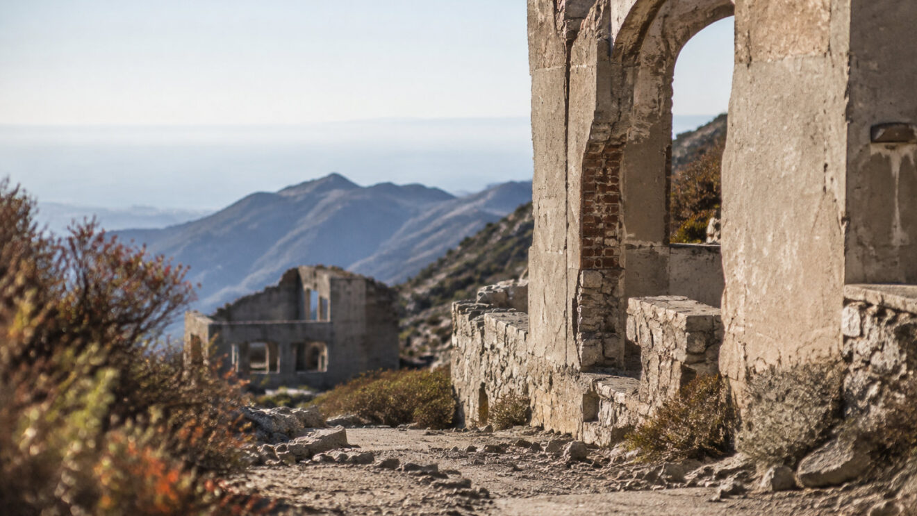
Few hikes near Los Angeles end at the ruins of a mountain resort built more than a century ago.
If you are thinking of walking there, the first question is whether the route is open to visitors. This article explains the route, how to reach its start, and what is left to see at the top.
Whether the Echo Mountain trail is open
When the closure applies
The Echo Mountain Trail and the Lower, Middle and Upper Sam Merrill Trails are closed from January 7, 2026 through December 31, 2027. Plan on no access before the end of 2027. No earlier reopening in stages is set.
If you want another hike while you wait, see the best Los Angeles hikes for 2026.
Starting at the Cobb Estate does not make this hike allowed. The route to Echo Mountain uses closed Forest Service trails, and the closure bans entry onto National Forest land in the closure area.
Do not plan this walk until the closure ends.
Which trails the closure covers
The closure covers more than the Echo Mountain Trail. It also includes Idlehour Trail, Castle Canyon Trail, Mount Lowe West Trail and Mount Lowe Trail (East). The Echo Mountain Picnic Site is closed too.
Before you plan a visit, check the Forest Service alert. For current information, call the Angeles National Forest at (626) 574-1613.
Where the trailhead is and how to reach it
Trailhead address and entrance
The usual starting point is the Cobb Estate entrance, at 3302 Lake Avenue, Altadena, CA 91001, near the junction with East Loma Alta Drive. Enter these coordinates in your GPS app: 34.20405, -118.1306.
Once inside the iron gate, the path follows the former estate drive to the Lower Sam Merrill Trail. Do not use this entrance until the closure has ended.
Driving directions and parking
By car, take exit 26 from the 210 Freeway in Pasadena and head north on Lake Avenue for about 3.5 miles. The road ends near East Loma Alta Drive, where the trailhead is.
There is no trailhead parking lot, so park on the nearby streets. Follow the posted signs, and do not block driveways.
Reach the trailhead by bus
-
Take Metro Bus Route 180
Get off at Altadena Drive and Lake Avenue.
-
Walk about one mile
No sidewalk covers the whole walk, so keep to the road edge, facing traffic. You reach the iron gate at 3302 Lake Avenue.
-
Check a nearby hike
For a waterfall hike nearby, see Eaton Canyon Falls.
Distance, climb and route
The standard out-and-back is about 5.5 to 5.8 miles (8.9 to 9.3 km), with a climb of about 1,400 feet (427 m).
Going out, you climb those feet, and coming back, you lose them.
Figures differ a little between trail descriptions, so treat these numbers as a guide and plan with a margin.
The route runs in this order:
- Start on the Lower Sam Merrill Trail and cross Las Flores Canyon.
- On the east side of the canyon, the switchbacks begin, about 2.5 miles of them.
- The last stretch joins the old Mount Lowe Railway route up to the summit area, about 3,200 feet (975 m).
How hard the climb is and how long it takes
How guides rate the difficulty
The standard route is rated moderate to strong moderate, and some call it hard. Expect a sustained uphill walk. The path is fairly level at first, then climbs through Las Flores Canyon on steep-feeling switchbacks.
The route gains about 1,400 feet, mostly on that climb. Where the turns are narrow, a slip could mean a steep drop, so watch your footing.
Time estimates for the round trip
For the standard route, plan on 2 to 3 hours for the round trip. Some estimates go up to about 3 hours, so use the longer figure if you want time to look around the ruins.
These times only apply once the closure ends. Until then, there is no safe walk to plan for.
Much of the climb has little shade, so you walk in strong sun for long stretches. The heat slows your pace and tires you sooner. On a hot day, treat the 2 to 3 hours as a minimum, and plan rest breaks in the few shaded spots.
What survives of the White City resort
Visible remains at the site
The White City resort stood on Echo Mountain. Visitors reached it by the Mount Lowe Electric Railway, which opened in 1893.
The trail and the picnic site are closed, so the ruins are closed to visitors too. Don’t plan a trip to see them while the closure lasts.
Start with the railway. You will see the railbed and ties, a platform, the trestle foundations, and parts of the large bullwheel from the railway powerhouse.
The resort side is harder to read. Look for the hotel foundation footprint, a staircase, and two large concrete water tanks. Rock walls around the former tennis courts and casino mark where those buildings stood.
The Mount Lowe Railway and its listing
Mount Lowe Railway
Route
- Carried visitors from foothill towns up to the mountain resorts
Ridership
- About 3.1 million visitors between 1893 and 1936
Recognition
- Listed on the National Register of Historic Places, the official U.S. list of protected sites
- Listed as a historic district
- Original listing: January 6, 1993
Staying safe on the climb
Carry at least 2 litres of water for half a day in the sun. The route has long exposed sections and no water along the way, so fill up before you set out.
Burned slopes shed loose soil and rocks, and dead trees can drop limbs or fall. Keep your distance from both. For a similar steep climb near LA, plan a Mount Baldy hike.
Follow these rules near the burn area:
- Obey closure signs. Do not enter the closed trails or the Echo Mountain picnic site.
- Stay out of closed canyons. Rain can trigger debris flows, flash floods and landslides.
- Call 911 in an emergency. For trail status, call the Forest Service at (626) 574-1613.
The Echo Mountain hike is closed, and so are the White City ruins. Starting at the Cobb Estate does not make it allowed. Until the closure ends, pick another hike.
Before you plan a trip, check the Forest Service alert. Once the trail reopens, carry plenty of water and give the climb the time it needs.
Frequently asked questions
Can I reach the White City ruins by another trail while the closure is in effect?
No. The Echo Mountain Trail and the nearby Sam Merrill sections are closed, so any other route into the closed area is off limits too. Don’t take another trail to reach the ruins until the closure ends.
Is there a fee or permit needed to hike to Echo Mountain?
No fee or permit is needed for the standard route to Echo Mountain. The trail is closed now, though, so that answer doesn’t help you yet. Once it reopens, you can walk it without paying or applying for anything.
Are dogs allowed on the Sam Merrill Trail?
No, not right now. The Lower, Middle and Upper Sam Merrill trails are closed under Forest Order 05-01-26-04, so don’t take your dog onto them. Dogs are allowed on the route when it is open.
Are there restrooms or drinking water at the Cobb Estate trailhead?
Don’t count on restrooms or drinking water at the Cobb Estate trailhead. Bring all the water you need for the hike when the trail reopens, and use a restroom before you leave home.

