Address: 7036 Mulholland Drive, Hollywood
Park features: Dogs On Leash, City Views, Parking Lot, Filming Location, Drinking Water, ADA Accessible
The most easterly of the Conservancy's Scenic Overlooks, the Hollywood Bowl Scenic Overlook is situated to provide a beautiful view of the Hollywood Bowl Amphitheater, downtown Los Angeles, and, on a clear day, the ocean and Catalina Island. To the east, the Hollywood Sign and Griffith Park Observatory are clearly visible, and to the north the San Fernando Valley. The Overlook was built concurrently with Universal City Overlook in 1984 in preparation for the Summer Olympics. Mulholland Scenic Parkway and Corridor The fifty five-mile Mulholland Scenic Parkway and Corridor is one of the most famous thoroughfares in the country. Constructed in 1924, twenty four-mile Mulholland Drive in the City of Los Angeles was envisioned by the famous Water Bureau Chief and City Engineer, William D. Mulholland, as a scenic road that would transport city dwellers to the mountains and beaches. The winding route starts west of the 101 Freeway in Hollywood, and offers panoramic city, mountain, and ocean views. Eight miles of the Scenic Parkway from the 405 Freeway west to Woodland Hills remain unpaved, and are subject to closure. Mulholland Highway starts in the City of Calabasas and twists through the Santa Monica Mountains for thirty miles to Leo Carrillo State Beach. Franklin Canyon Park, and Fryman Canyon Park are accessed from Mulholland Drive. The Conservancy maintains seven scenic overlooks on Mulholland Drive.
Getting around
The Jerome C. Daniel Overlook is a roadside scenic vista on Mulholland Drive, directly above the Hollywood Bowl — an ADA-accessible viewing terrace with sweeping panoramas of the Hollywood Bowl shell, Griffith Observatory, downtown LA and the Hollywood Sign. It is a photo and sunset stop rather than a hiking trail. For a connected ridge walk, the Dirt Mulholland and Runyon Canyon trails start a short drive west.
Location
7036 Mulholland Drive, Hollywood
Approximate coordinates: 34.1297, -118.3417
View on OpenStreetMap
Photos
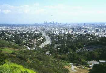
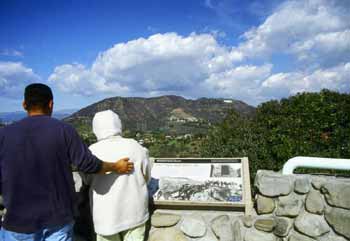


Photo credits: Karin Mueller (1-4)
Related documents
Nearby parks
Park description restored from the 2017 lamountains.com archive (Santa Monica Mountains Conservancy). Trail statistics courtesy of AllTrails. Map data © OpenStreetMap contributors.