
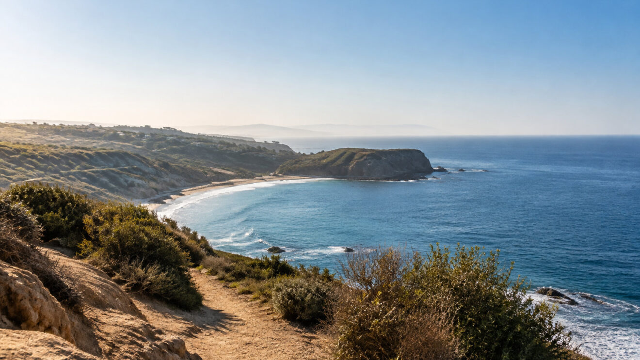
Is a short coastal loop an easy morning once tide and parking enter the picture? Closed roads, few spaces and a beach that can cut you off change the plan.
This Point Dume hiking trail guide shows what to check before you leave.
Point Dume hiking trail guide: routes, viewpoints and beach access
The main bluff loop starts at Westward Beach Road
The main Point Dume walk begins at the end of Westward Beach Road, and it is the starting point for the wider network of Santa Monica Mountains trails. From the cul-de-sac, the trail climbs gently onto the coastal bluff.
The short preserve loop is the easiest choice:
| Short preserve loop | Details |
|---|---|
| Distance | About 1 mile |
| Elevation gain | Roughly 100 feet |
| Time | 30 to 45 minutes without a beach detour |
The climb is short, but the surface is sandy and uneven, and the steps near the beach route are steeper. Wear shoes with firm grip, especially after rain or during high tides.
A fenced trail leads to the summit and a sheltered platform
A fenced path crosses coastal grassland and bluff scrub toward the high point. Below the summit, a boardwalk leads to a viewing platform that breaks the coastal wind.
The summit is more exposed than the platform. Stay back from the cliff edge, particularly when you photograph the view or walk with children.
The summit is more exposed than the platform. Keep well back from the edge, especially when photographing the view or walking with children.
Two short accessible trails cover the lower ground
Point Dume has about two miles of scenic trails. The named accessible routes are short, so they suit anyone who wants the views without the full bluff network.
| Accessible trail | Poppy Trail | Coreopsis Trail |
|---|---|---|
| Length each way | 0.06 mile | 0.09 mile |
| Route | Compacted aggregate surface, about 5 feet wide on average | From near Poppy Trail to Cliffside Drive |
| Slope | Up to 8 percent | Generally flatter, but a staircase leads down toward Big Dume Beach |
Stay on fenced or marked trails. Off-trail shortcuts damage the sandy bluff and coastal habitat. Dogs are not allowed on the trails or the beach, and you may not remove plants, rocks or tide-pool life.
Beach access at Point Dume depends on tides and closures
The east-side beach route starts on the bluff and runs down a long staircase near Coreopsis Trail. It reaches Big Dume Beach, where rocks and tide pools are exposed as the tide drops.
Check the tide chart before you go down. A rising tide can cover the narrow sand at the foot of the stairs and cut off the way back, even when the water looks calm.
The lower shoreline has wet rock. It also has loose stones, cliff edges and breaking surf.
Do not enter coves or tide pools if waves reach the access stairs, and allow enough time to climb back before the tide turns.
Public vehicles are not allowed on the road past the Westward Beach pay gate. They are also barred from the lower Point Dume parking area. Coastal erosion and emergency repairs are the reason. The bluff-top preserve is reached separately from Cliffside Drive.
The preserve has no public restrooms and no public phones.
What to do before you start from the bluff-top entrance
- Carry water.
- Bring a charged phone.
- Use the facilities before you start from the bluff-top entrance.
Do not cross cones, caution tape or fencing near the damaged road or the bluff edge. Erosion has left unstable drop-offs. They sit close to visitor routes.
Parking at Point Dume is limited, so check the road before you drive
Bluff-top spaces fill first
Parking on nearby residential streets is prohibited. If the Cliffside spaces are full, use a legal alternative at Westward Beach. Use it only when the access road and lot are open.
The lower lot stays closed while Westward Beach Road is shut beyond the pay gate. That makes the bluff-top spaces more important. Arrive early and follow every posted time limit.
Before you park
- Confirm the Cliffside spaces are free before you commit to them.
- Check that the access road and lot at Westward Beach are open.
- Arrive early, since the bluff-top spaces fill first.
- Read and follow every posted time limit.
Driving route from Santa Monica
From Santa Monica, follow Pacific Coast Highway west for about 18 miles. Then turn onto Westward Beach Road. The standard beach-level approach runs to the end of the road.
The bluff-top area is open for day use from sunrise to sunset. The State Parks entrance and the county beach access are separate. A closure at one does not close the other.
Bus 534 is an alternative to driving
Metro Bus 534 stops at Cliffside/Dume on Pacific Coast Highway. From there, walk along Cliffside Drive to the preserve entrance. Check the current timetable before you travel.
Solstice Canyon and Escondido Falls offer longer walks nearby
The main Solstice Canyon lot opens at 8 a.m. and closes at sunset. Weekend spaces fill fast. Cars parked illegally on Corral Canyon Road can be towed.
The waterfall flows best after recent rain. But wet conditions make the final approach slippery. Wear stable shoes. Do not climb wet rock around the falls.
Two routes, two different walks
-
Solstice Canyon
Solstice Canyon offers shade, ruins and a creek. It is the shorter option, with the lot and the main sights close together.
-
Escondido Falls
Escondido Falls adds a longer woodland walk with seasonal water. Plan more time and carry enough water for the full loop.
The trailhead is on Pacific Coast Highway, near Winding Way. Parking is limited. Arrive early. Never block driveways or narrow road sections.
Before you set out, check the tide chart, carry water and a charged phone, and aim to arrive early for the bluff-top spaces. Stay on marked trails, respect every closure, and allow time to climb back before the tide turns.
Frequently asked questions
Can I swim at Point Dume Beach?
Yes. Swimming, surfing and diving are all listed activities at the county beach, but lifeguards are on duty during daylight hours only, so plan to be out of the water before dark. Check the current beach advisory and surf conditions before you go in.
Is Point Dume part of a marine protected area?
Yes. The waters around Point Dume include the Point Dume State Marine Conservation Area and the Point Dume State Marine Reserve. Both restrict the removal of marine life and other resources, so shells, animals and tide-pool organisms must stay where they are.
Can I visit Point Dume for whale watching?
Yes. The bluff is a land-based viewing point for migrating gray whales, and the main season runs from late autumn through spring. Bring binoculars and scan offshore from the summit or the viewing platform, which breaks the coastal wind and makes long watches more comfortable.
