The Mt. Baldy summit trail is extremely hazardous right now. Serious injuries and deaths have happened there and on other high routes.
Before you drive up, you need to know whether the trail and summit are open and safe that day. This article shows which conditions to check, where to check them, and when to turn back.
Why the summit route is not a routine hike right now
Do not treat the summit trail as a routine hike right now. The Mt. Baldy Trail is extremely hazardous at the moment.
Serious injuries and deaths have happened on this trail, on Ice House Canyon Trail and on other high routes.
The trail runs 5.6 miles and climbs nearly 4,000 feet, a long day even in good weather. Confirm the conditions for that day before you drive up. If you cannot, choose a lower hike.
Check the current forest alerts before you leave home. Closures can be posted at any time, so a trail that was open last week may be closed today. Driving to a closed trailhead wastes the trip, and going past a closure sign is a violation. If the mountain is closed, look for a lower option in the best hikes in Los Angeles.
What snow and ice do to the upper trail
Above about 7,500 feet, expect hard snow or ice on the trail. Each step there can slip, and the route is harder to follow.
Three days of snowfall added 16.7 inches. Six inches or more can bury the trail, so the route disappears under the snow. If you cannot see the trail markers ahead of you, turn back.
Above 7,500 feet, carry this gear and have this training before you step onto snow or ice:
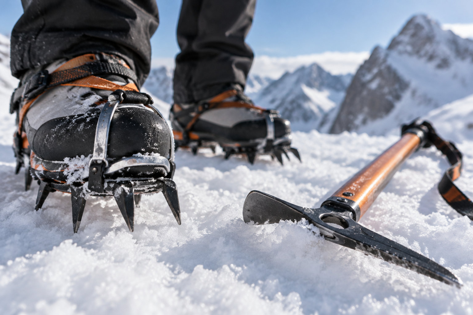
- Crampons, an ice axe and a helmet. On the icy parts of the Ski Hut Trail, you need all three, because a slip on steep ice may not stop.
- Mountaineering boots, plus training in how to use crampons and an ice axe on icy ground.
- Stay off steep open slopes after new snow and wind. North-facing slopes stay icy or snowy longer, since they get little sunlight.
Why the foothill forecast undersells the summit wind
The base forecast covers about 5,538 feet, not the 10,064-foot summit. Up top, the air is colder and the wind is stronger, even on a sunny day.
The 66°F high and light southwest breeze of about 5 mph apply to the base only. Before you leave, check the updated point and hourly forecasts, then dress and set your turnaround time for the colder, windier top.
Base and summit readings measure different things, so keep them apart.
| Measure | Base station, 4,242 ft (Oct 24) | Summit (Oct 24) |
|---|---|---|
| Temperature or feel | 61°F air temperature at 11 a.m. PDT | Wind chill of 17°F, the cold you feel on skin |
| Wind | North wind at 1 mph | Gusts up to 24 mph |
| Where it applies | One spot low on the mountain | The top section, where wind is strongest |
To build up for the summit, see progressive hikes on the Vivian Creek trail.
How to check the road before you drive up
Check the road on the day you drive, just before you get in the car. Road conditions can change overnight, so what you saw yesterday may no longer hold. Open Caltrans QuickMap for closures, incidents and chain controls.
The chain-control information on the map updates about once a minute, so a look just before you leave shows the current status. If the map is unclear or you have no signal, call the Caltrans Highway Information Network at 800-427-7623.
Chain control levels set what your vehicle needs on the mountain road:
- R-1: chains are required, except for passenger vehicles and light trucks under 6,000 pounds with snow tires on at least two drive wheels. Those vehicles must still carry chains.
- R-2: chains or traction devices are required, except for four-wheel-drive or all-wheel-drive vehicles with snow-tread tires on all four wheels. Those vehicles must still carry traction devices.
- R-3: chains or traction devices are required on every vehicle.
Whether the lift runs and where to park
Treat the chairlift as closed until you confirm it runs. The resort was closed for the 2025–26 season, so do not assume it runs today. Check the lift and the parking as two separate questions.
A lift that runs does not mean the lot is open, and an open lot does not mean the lift runs. Confirm each one before you leave, and plan to hike from the trailhead if the lift is down.
Check the lift before you plan a ride
What works
Read the daily operating report on the day you plan to ride, and find the lift status for that day.
What to avoid
Assume the lift runs because it ran on your last visit.
What works
During the regular season, expect closures to rotate from Monday to Wednesday, and check those days first.
What to avoid
Plan a Tuesday ride without checking, since a closure can fall on that day.
Where to turn back and what to carry
Turn back below 6,950 feet if you have no winter gear and no snow training. Check your elevation on a map or GPS app before you reach that point.
Cell service in the forest can be very weak or gone, so don’t count on your phone to call for help.
If you have a signal, dial 911. Before you leave, tell someone your route and when you expect to be back.
Before you start up a winter trail, pack these items:
- A map and compass, plus a personal locator beacon for when your phone has no signal.
- A flashlight, sun protection, and a first-aid kit.
- A knife, a fire starter, and an emergency shelter.
- Extra food, extra water, and extra clothing for the cold and wind higher up.
Mount Baldy is not a routine hike right now. Before you drive up, check the alerts, the road, the lift, the parking and the summit forecast.
If you cannot confirm that the trail is open and safe that day, choose a lower hike.
Your next step: check the forest alerts again just before you leave.
Frequently asked questions
Is there currently snow on Mount Baldy?
Yes, there is snow on Mount Baldy. Three days of snowfall before October 24, 2026 added 16.7 inches, and hard snow or ice covers the trail above about 7,500 feet.
Plan for snow on the upper trail before you drive up.
How hard is it to summit Mount Baldy?
It is a hard climb. The Mt. Baldy Trail runs 5.6 miles from the village to the summit and climbs nearly 4,000 feet.
With snow and ice on the upper trail right now, reaching the summit can require mountaineering equipment and training.
Why is Mount Baldy closed?
Mount Baldy’s ski resort is closed for the 2025–26 season, so the chairlift is not running. That closure covers the resort only. For trail closures, check the forest alerts before you set out, since they are posted separately.