Physical exertion during a high-intensity climb significantly amplifies pollutant inhalation, as minute ventilation increases and bypasses nasal filtration. For Los Angeles hikers, understanding the air quality index is a technical necessity to prevent pulmonary inflammation and vascular impairment caused by fine particulate matter.
Network security protocols and data gaps often obstruct access to real-time local forecasts in remote canyon areas. This guide details how to check air quality for hiking by utilizing specialized sensor networks and visual benchmarks to mitigate respiratory risks on the trail.
- Decoding the Air Quality Index for Los Angeles Hikers
- How to monitor local conditions in remote areas?
- Physical symptoms signaling immediate trail evacuation
- 3 ways to adjust your Los Angeles hiking itinerary
Decoding the Air Quality Index for Los Angeles Hikers
The AQI scale ranges from 0 to 500, with levels above 100 posing risks for sensitive groups. Hikers should cancel strenuous climbs when PM2.5 concentrations exceed 55.4 µg/m³, typically found in the “Unhealthy” red zone.
Numerical thresholds and physiological risk categories
The standard index operates on a 0 to 500 scale. Green (0-50) and yellow (51-100) zones indicate acceptable conditions. These levels are generally safe for most outdoor activities.
Orange and red tiers signal increasing danger. Values between 101 and 150 threaten sensitive groups specifically. Above 150, everyone experiences adverse effects. Strenuous exercise becomes dangerous for your heart.
Exerting yourself in the ‘Very Unhealthy’ purple zone is equivalent to smoking several cigarettes during your uphill climb.
Specific impact of PM2.5 on lung function during climbs
PM2.5 particles are small enough to reach the bloodstream. They trigger immediate inflammation within internal lung tissue. This corrosion damages the delicate alveolar walls.
Hard breathing increases toxin inhalation significantly. This process reduces overall oxygen uptake efficiency. Consequently, your muscles reach fatigue much faster than normal.
Frequent exposure causes long-term respiratory damage. Checking air quality before your next LA hike is vital for safety. Review Monterey Park outdoor programs for localized environmental updates.
How to monitor local conditions in remote areas?
Digital tools are great, but they aren’t always available when you’re deep in the Santa Monica Mountains.
Digital forecast platforms and real-time sensor networks
AirNow provides official regulatory data, while PurpleAir utilizes hyper-local sensors for immediate feedback. These consumer-grade devices offer a granular view of neighborhood-level smoke. Real-time data remains the most effective tool for hikers.
- AirNow for official government forecasts.
- PurpleAir for real-time local trends.
- Windy.com for monitoring smoke drift patterns.
Wind patterns dictate local safety. Onshore breezes typically clear the air for coastal trails. Conversely, offshore winds frequently transport inland smog or wildfire smoke toward the Pacific coastline.
Visual cues for assessing visibility in the field
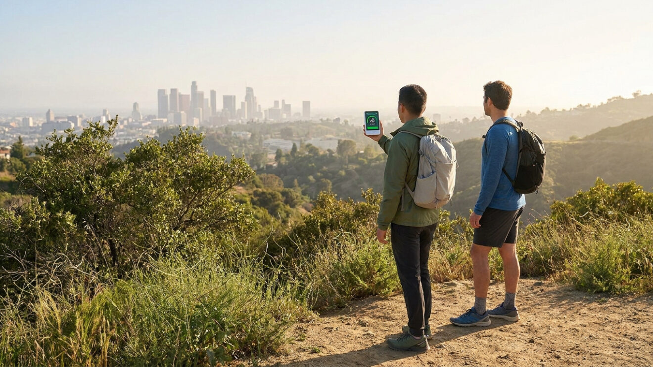
Establish reliable visibility benchmarks before ascending. If the downtown skyline is obscured from the Hollywood Hills, air quality is likely poor. Use mountain ridges as distance markers; clear days produce sharp, distinct edges.

Differentiate smoke from marine layers. Smoke smells acrid and appears brownish. Fog is white, odorless, and typically dissipates by noon. Do not confuse these distinct atmospheric conditions while on the trail.
Use mountain ridges or the downtown skyline as visibility benchmarks; if outlines are blurry or brown, air quality is likely poor.
Utilize offline techniques when signals fail. Hikers visiting Castro Crest should rely on these visual distance markers to gauge safety without active cellular data.
Physical symptoms signaling immediate trail evacuation
Even with the best data, your body remains the most accurate sensor for local pollution levels.
Recognizing early respiratory and cardiovascular distress
Randonneurs must monitor specific warning signs. Persistent coughing serves as a primary indicator of poor air quality. Sudden dizziness or a scratchy throat necessitates an immediate evacuation from the trail.
Distinguishing standard exertion from pollution-induced distress is vital. Normal hiking causes manageable fatigue. In contrast, high pollution levels create a heavy chest sensation and a feeling of air deprivation.
| Symptom | Normal Fatigue | Pollution Warning |
|---|---|---|
| Coughing | Rare or occasional | Persistent and dry |
| Breathlessness | Expected during climb | Heavy chest tightness |
| Heart Rate | Steady and rhythmic | Irregular or rapid |
| Recovery Time | Fast after resting | Slow and lingering |
Managing risks for sensitive groups and frequent hikers
Sensitive populations require increased vigilance. Children and seniors exhibit higher respiration rates than average adults. Asthmatics must strictly adhere to lower AQI limits to prevent severe respiratory incidents.
Regular visitors to the hiking archives should consider the cumulative effects of exposure. Constant inhalation of fine particles leads to long-term cardiovascular and respiratory strain for frequent trail users.

Seeking professional medical advice is a prudent step for daily hikers. Doctors can evaluate lung capacity and baseline health. Prioritizing safety over completing a trail remains the most professional approach.
3 ways to adjust your Los Angeles hiking itinerary
You don’t always have to stay home; you just need to change where and when you go.
Optimal timing to avoid peak afternoon ozone levels
Sunlight and heat cook pollutants into ground-level ozone. This chemical reaction peaks in the late afternoon. Early morning starts are the safest bet for hikers.

Avoid sunset hikes during heatwaves. The air hasn’t cooled down yet. Pollutants remain trapped at ground level. Wait for a cooler day instead.
Selecting lower elevation or coastal backup trails
Consider coastal alternatives like El Matador State Beach. These areas offer immediate relief from inland smog. Ocean breezes provide much cleaner air for breathing.
Deep valleys can hold smog like a bowl. Coastal areas benefit from the marine layer. This breeze pushes pollution inland. It keeps the shoreline significantly clearer.
Protective equipment and hydration for moderate conditions
N95 masks filter particles but increase breathing resistance. Use them only for light walking. Hydration is equally important for soothing your throat and respiratory tract.
N95 masks increase breathing resistance; they should only be used for light activity and are not a substitute for avoiding high-pollution zones.
A well-sealed N95 mask is a tool of last resort, not a green light for a summit sprint.
Protecting your respiratory health requires monitoring AQI thresholds and recognizing physiological distress signals like persistent coughing. Utilize real-time sensor networks to verify local conditions before heading out. Master how to check air quality for hiking today to ensure every Los Angeles climb remains a vitalizing, peak-performance experience.
FAQ
How is the Air Quality Index (AQI) calculated for outdoor activities in Los Angeles?
The Air Quality Index (AQI) is a standardized system developed by the EPA to quantify outdoor air pollution levels on a scale from 0 to 500. This metric is divided into six color-coded categories, where values under 100 are generally considered acceptable, while levels exceeding 150 signify “Unhealthy” conditions for the general population. The index primarily monitors PM2.5 concentrations, which are fine particles that pose significant respiratory risks during physical exertion.
What are the specific health risks of hiking when PM2.5 levels are high?
Exposure to PM2.5 particles, those smaller than 2.5 micrometers, allows pollutants to penetrate deep into the internal lung tissue and reach the alveolar sacs. This triggers oxidative stress and pro-inflammatory cytokine production, which compromises lung function and reduces oxygen uptake. For hikers, this physiological strain results in accelerated muscle fatigue and potential long-term respiratory damage, particularly when performing strenuous climbs in the “Very Unhealthy” purple zone.
Which digital tools provide the most accurate real-time data for remote trails?
To obtain real-time data in areas with limited regulatory monitoring, hikers should utilize hyper-local sensor networks such as PurpleAir or the Clarity sensors integrated into the EPA’s Fire and Smoke Map. These platforms supplement official AirNow forecasts by providing high-resolution, neighborhood-level insights. Additionally, the “Know Your Air Network” managed by local districts offers precise metrics on PM2.5, PM10, and NO2 concentrations in various Southern California sectors.
How can I differentiate between coastal fog and wildfire smoke while on the trail?
Visual cues are essential for field assessment when digital access is restricted. Smoke typically presents as a brownish haze with a distinct acrid odor, whereas fog is white, odorless, and often dissipates by midday. Hikers can use mountain ridges or the downtown skyline as visibility benchmarks; a lack of sharp edges on distant landmarks often indicates high particulate matter. If visibility is severely obscured, immediate evacuation is recommended to avoid respiratory distress.
What symptoms indicate I should terminate my hike due to poor air quality?
Immediate signs of pollution-induced distress include persistent coughing, a scratchy throat, and sudden dizziness. Unlike normal physical fatigue, pollution exposure creates a sensation of chest heaviness and an inability to achieve adequate breath. Sensitive groups, including children, seniors, and individuals with asthma, must adhere to lower AQI limits and should cease activity immediately if these cardiovascular or respiratory red flags manifest.
When is the best time of day to hike to minimize ozone exposure?
Ground-level ozone reaches peak concentrations during the late afternoon, as sunlight and heat catalyze pollutants. To mitigate risk, early morning starts are highly recommended, as the air is typically cooler and pollutants have not yet reached maximum levels. During heatwaves, hikers should avoid sunset excursions, as the marine layer may not have yet displaced the trapped inland smog or wildfire smoke.
Are N95 masks effective for high-altitude hiking in moderate pollution?
A well-sealed N95 mask can filter harmful particulates, but it significantly increases breathing resistance, which can strain the cardiovascular system during steep ascents. These masks should be viewed as a tool of last resort for light walking rather than a solution for strenuous summiting. Maintaining high levels of hydration is equally critical to protect the throat and mucous membranes from irritation caused by dry, polluted air.