
Address: PCH to Topanga Cyn, left at Fernwood Pacific Drive.
Park features: Dogs On Leash, Easy Hiking, Equestrian, Mountain Biking, City Views
Stunning, 1,255-acre Tuna Canyon Park in the western Santa Monica Mountains above Pacific Coast Highway in Malibu parallels more than two miles of the Pacific Ocean, and provides dramatic, 360-degree views of the San Gabriel mountains to the Santa Monica Bay. Tuna Canyon Park links over 18,000 acres of contiguous protected open space from Topanga State Park west to Las Flores Canyon. More than half of the property lies within Los Angeles County Significant Ecological Area Number 10. Deep canyons and ridges support a rich mosaic of coastal Southern California plant communities including sycamore riparian woodland, coastal sage scrub and native grasslands. Tuna Creek, one of the most pristine aquatic habitats in the Santa Monica Mountains, courses through the eastern end of the property to the ocean.
Trails & hiking
Featured route: Tuna Canyon Trails (trail details & live conditions on AllTrails)
- Distance: 3.8 mi (6.1 km) — Out & back
- Elevation gain: 639 ft (195 m), high point 1807 ft
- Difficulty: Moderate
- Typical time: 1.5–2 hr
- Rating: 4.7/5 (2,628 AllTrails reviews)
- Good for: Hiking, Mountain biking, Trail running
- On the trail: Dogs on leash, Kid-friendly, Views, Wildflowers, Wildlife
Conditions vary by season. Check live weather and air quality on the AllTrails trail page before heading out.
Location
PCH to Topanga Cyn, left at Fernwood Pacific Drive.
Approximate coordinates: 34.0725, -118.5985
View on OpenStreetMap
Photos

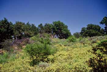
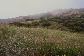
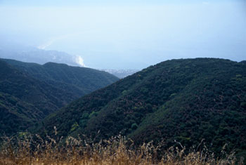
Photo credits: Karin Mueller (1-4)
Related documents
Nearby parks
Park description restored from the 2017 lamountains.com archive (Santa Monica Mountains Conservancy). Trail statistics courtesy of AllTrails. Map data © OpenStreetMap contributors.


